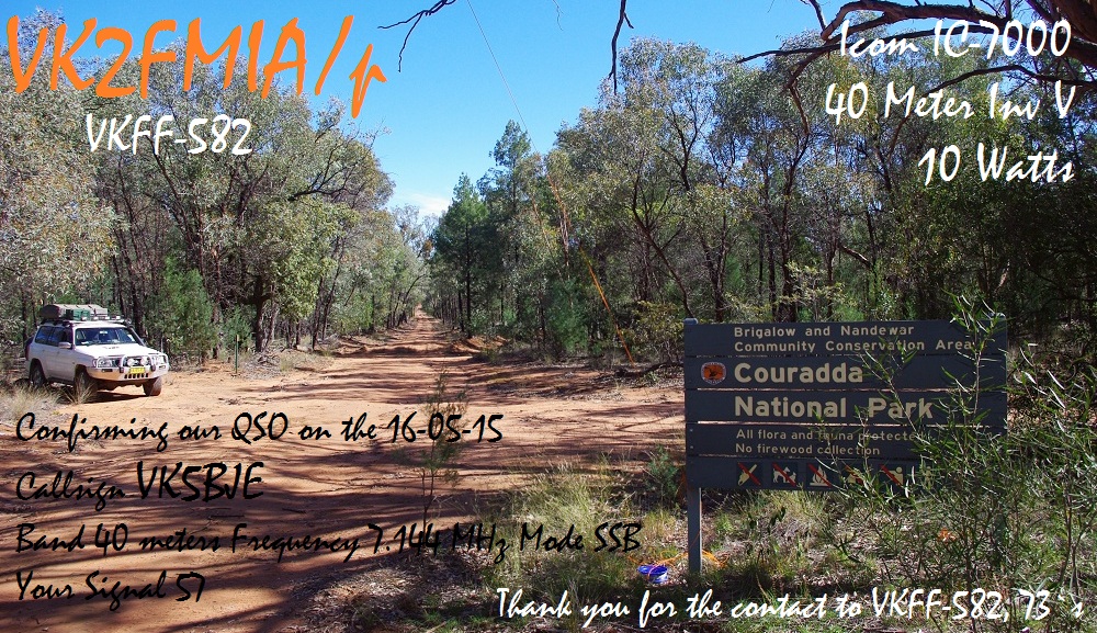
Couradda National Park
I had another contact with Doug, VK2FMIA, on the 16th May, from Couradda National Park. Thanks Doug for the splendid card.

Couradda National Park
I had another contact with Doug, VK2FMIA, on the 16th May, from Couradda National Park. Thanks Doug for the splendid card.
After successfully activating Mount Ainslie, VK1/AC-040, we travelled the short distance to Black Mountain, VK1/AC-042. In 2010, at the 100th Anniversary AGM of the WIA we visited the Telstra Tower for an inspection and dinner later in the restaurant. This time we were looking forward to coffee!
While the sun was still shining the wind was ferocious. Andrew’s squid pole came down at least twice and on one occasion the operator at the other end gave a 5 and 9 report with the squid pole erected and 5 and 2 when collapsed! We were joined by Heath, VK3TWO and his partner, Monique and we persuaded Heath he should join the activation as well.
Despite the weather we successfully activated the Peak and also gain a six metre contact. After contacting VK1DI, Ian on 40 metres, he agreed to migrate to six metres and we all contacted him on 52.200 ssb. The six metre contact was a first for me portable and Paul and I both resolved to make dipoles for this band.
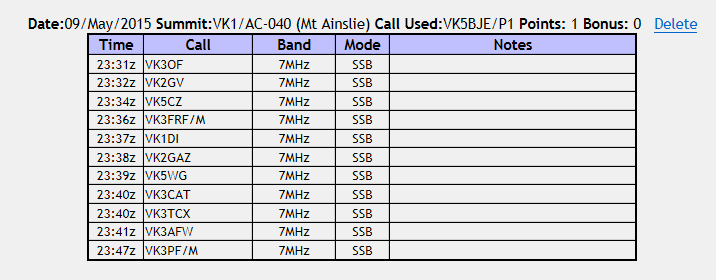
Here is my log.
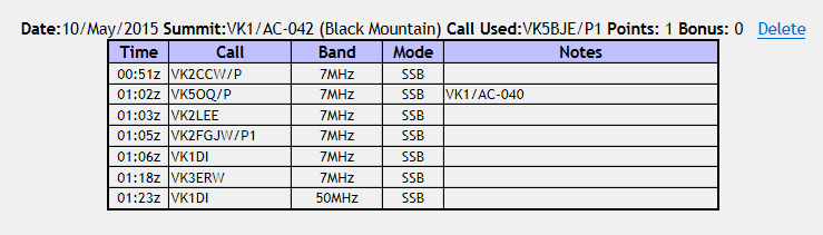
Black Mountain, VK1/AC-042 log
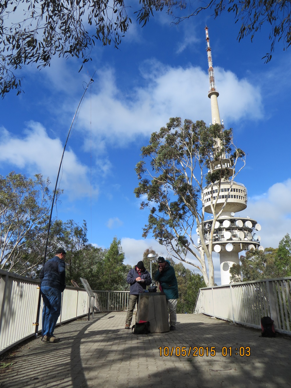
VK1NAM, VK5PAS & VK5BJE
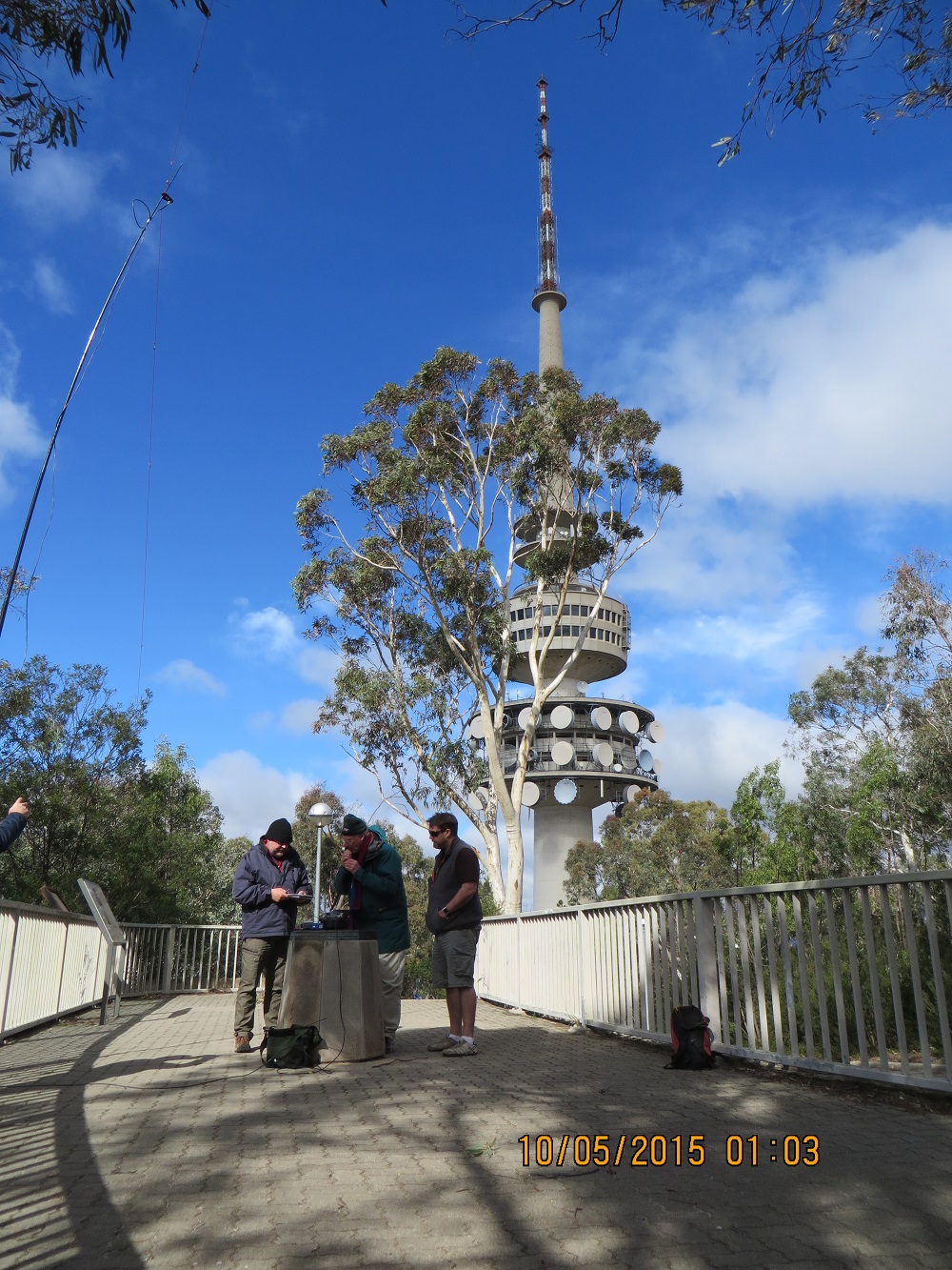
VK5PAS (log-keeper), VK5BJE (on-air) & VK3TWO (supervisor)
At last, coffee in the tower restaurant!
Here is a link to a video taken by Andrew, VK1NAM/P1 of the activation on Black Mountain.
On Sunday morning VK5PAS, Paul and I met Andrew, VK1NAM, who had arranged on Saturday afternoon at the WIA AGM, to take us out for more SOTA activations if the weather was reasonable. Well the weather was wet on Saturday evening and the weather bureau predicted strong winds and more rain for Sunday. Paul and Andrew had discussed the matter earlier and we agreed we would all go and take one peak at a time and stop the activations if it became necessary.
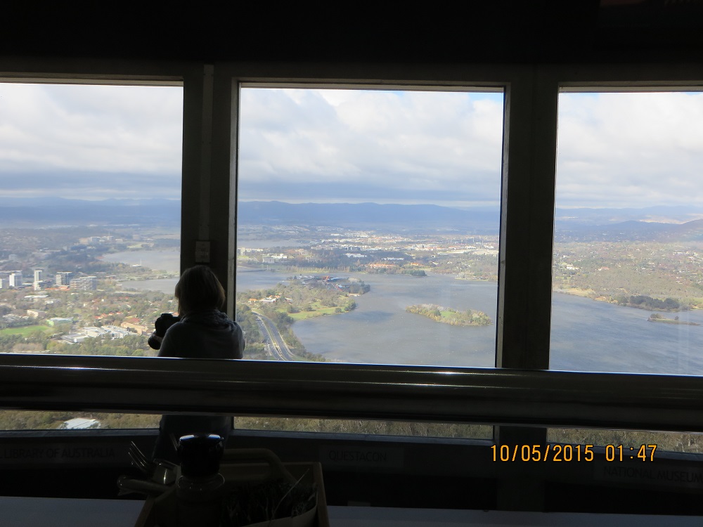
So we set out for Mt Ainslee, VK1/AC-040. This peak is right in Canberra and accrues one point for a successful activation. The winds were gale force. However, we successfully activated the Peak and took some photos before setting out for Black Mountain, VK1/AC-042, just a short drive away.
Eleven contacts were made. When the activation was finished we set out for Black Mountain, VK1/AC-042.
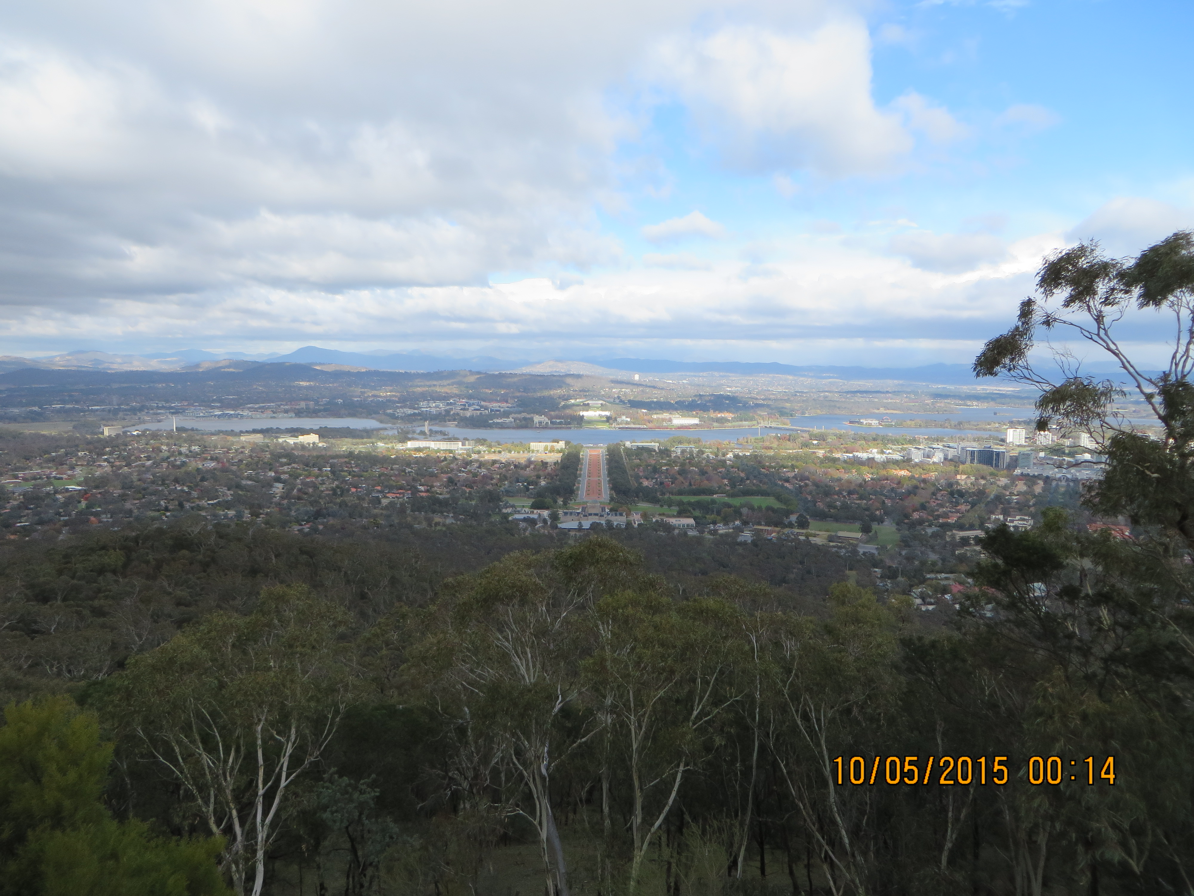
Canberra from Mount Ainslie
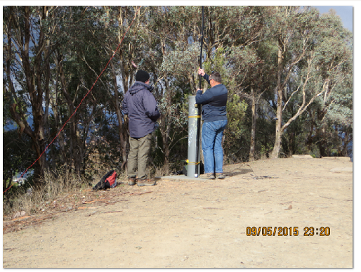
Andrew setting up squid pole in the wind
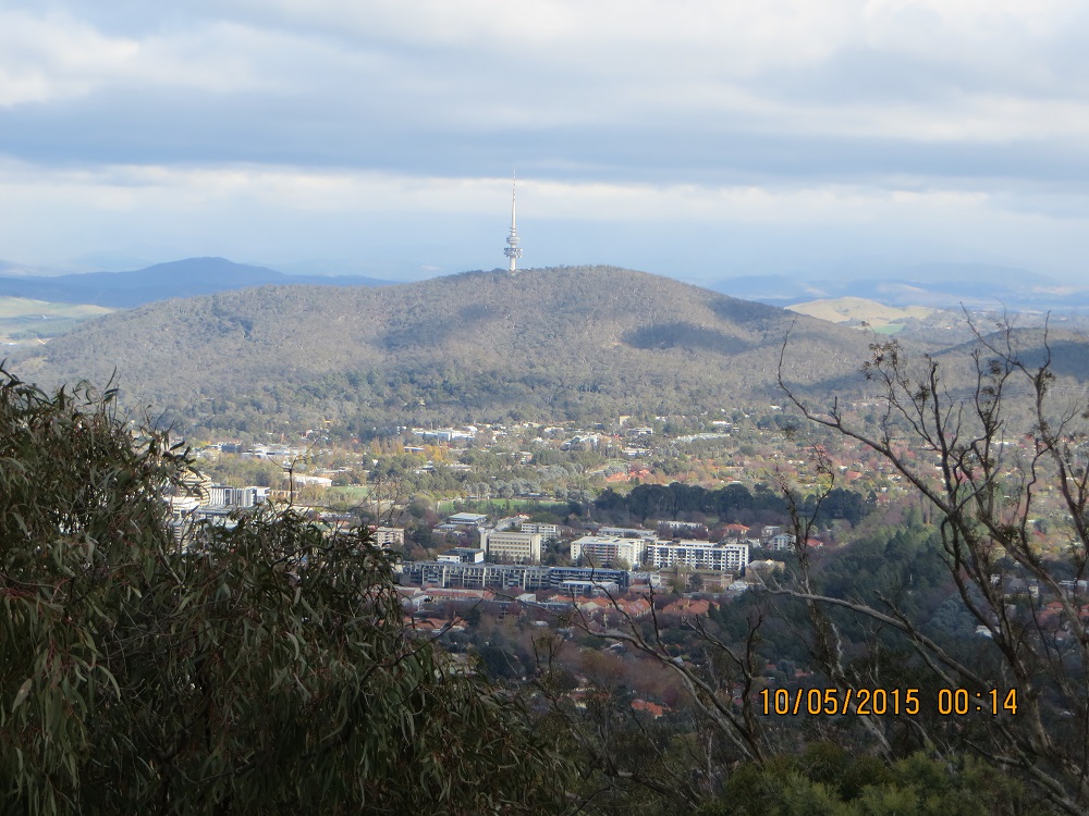
Black Mountain from Mount Ainslie
I would like to thank VK1NAM, Andrew, who so generously gave up a fair bit of his Sunday to enable me, Paul and Heath to enjoy these activations. The activations on Thursday and Sunday enriched an already splendid weekend at the WIA AGM. On Sunday evening we enjoyed a casual meal with members of the Canberra Amateur Radio Club. I also enjoyed the presentation of home brewed equipment from members of the Club which was on display during the AGM. This display was orientated to low frequency transmitters and audio equipment. The gear was impressive and mainly illustrated published articles from Amateur Radio Magazine. Finally, of course there are the chasers. Without chasers we would have become cold and wet for nothing!
After lunch we travelled to Mt Ginini. While the sun was still shining the temperature had dropped to 4 degrees Celsius and the wind was blowing really hard. It was also very cold! We all activated the summit successfully and I secured ten contacts. Mt Ginini, like Mt Coree is in Namadgi National Park, VKFF-377 and these ten contacts together with the 15 from Mount Coree means I have successfully activated the Park for the VKFF program. By the time we had finished our activation the temperature had dropped to two degrees Celsius. It was very cold and the wind chill factor was severe. I thought it was going to snow.
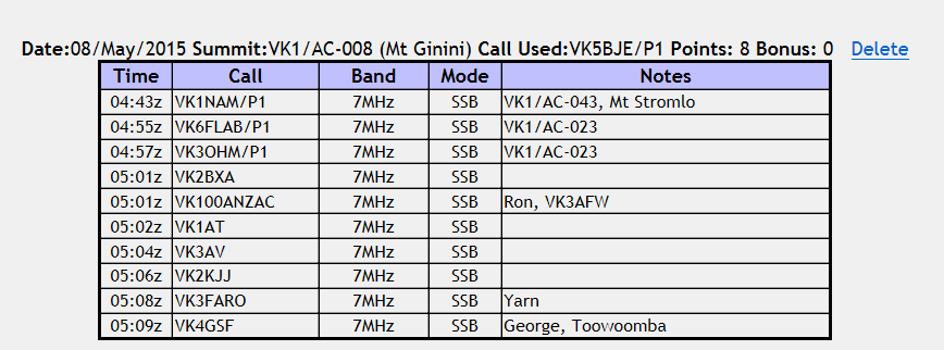
Mt Ginini log
VK1/AC-008
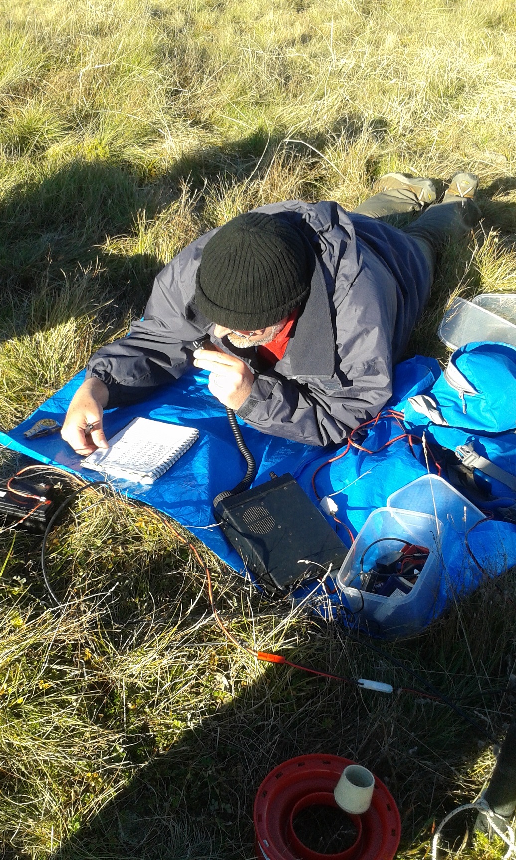
Mt Ginini has been a place I have long wanted to see. It is, of course, the site of the ACT repeater, VK1RGI, 149.950 – 600Khz transmit, also 91.5 Hz tone, provided by the Canberra Amateur Radio Club: a repeater I have used on previous visits to the ACT and while in New South Wales. But Mt Ginini is also a very significant peak in the Brindabella Ranges also known as the Brindabells. Mt Ginini is 1,762 metres above sea level (5,781 feet). The NSW/ACT border runs along the ridge of the Brindabella Range and the surveyors would have had lots of challenges in their work during the early part of the 20th century.
The picture below shows VK5PAS/P1 operating a Icom IC703, ten watt transceiver, contacting European stations from Mt Ginini. He is in a prone position to minimise the cold wind.

On Thursday 7th May I flew to Canberra for the Annual General Meeting of the Wireless Institute of Australia (WIA). The WIA is the oldest national amateur radio society in the World and I had previously attended the 100th anniversary AGM in Canberra in 2010. That AGM was splendid. I knew this one would be different and I was looking forward to participating. But as the AGM did not begin until 18:00 hours on Friday I had the day to do other things. Some of the Australian Capital Territory (ACT/VK1) amateurs had promised to take me (and my colleague from Adelaide, VK5PAS, Paul) to the some of the local summits which we would activate for SOTA.
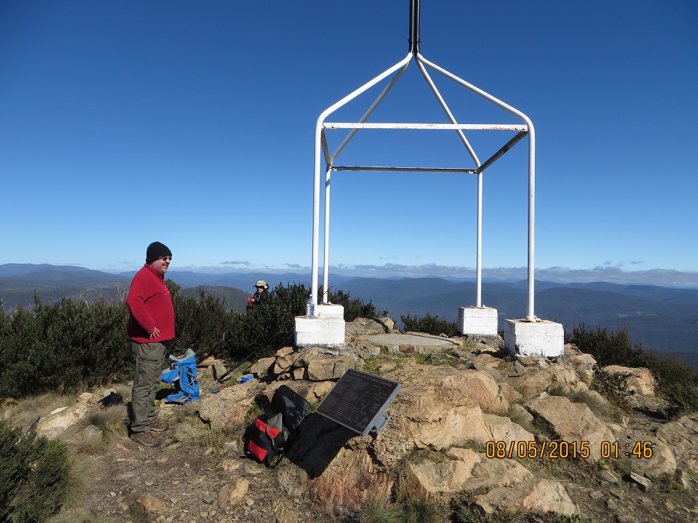
The Trig Point at Mt Coree.
Andrew, VK1DA was our guide, mentor and used his station to ensure we could activate two summits and see some of the peaks and natural areas which are so significant in the ACT. So after checking our arrangements with Andrew, VK1DA, we were on the road at 10:00 driving to two peaks in the Brindabella Ranges. The first peak was Mt Coree which has the SOTA reference, VK1/AC-023. It was a cool sunny day with a slight breeze. To get to Mt Coree was about an hour and a half over some sealed roads, but mainly gravel roads and, finally, a rough track to take us about 300 metres below the summit. We then walked to the summit and used the trig point to secure the squid pole. By the time we reached the summit the breeze had changed to a howling wind!
I was able to secure 15 contacts with amateurs in VK1, 2, 3 and 5 on the 40m band. Also Andrew and Paul activated the summit. It was cool and the wind was blowing hard, but it was great fun and I was delighted to secure my first summit in VK1, and my third SOTA Association as I have previously activated summmits in VK3 and VK5. After completing our activation we arranged to meet Marc, VK3OHM/P1 and Ono, VK6FLAB/P1 at a picnic spot on our route to Mount Ginini and their route to Mr Cooree. We were swapping peaks!
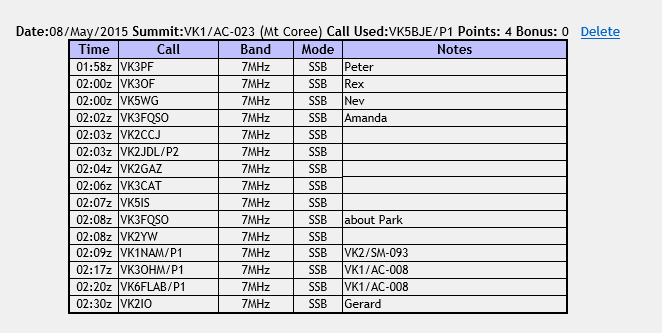
Mt Coree Log
The ACT Government web page, link above, indicates that the survey of the border began in 1910 and was completed in 1915. A plaque is in place at Mt Coree, where the work began on the survey at the Trig Point, to commemorate the achievements of the survey team. I recommend a look at the ACT planning site (URL above) and particularly the page on the border markers and accuracy. It is impressive. So we were there in the Centenary Year.
The Park
I have written about the Park on previous occasions. Here is a link to my last activation on Australia Day 2015. https://vk5bje.com/category/sa-national-park/belair-national-park/
It is sufficient to repeat that this Park was South Australia’s first and, as you can see from the maps on my blog, it is not far from the Adelaide city business district. Belair is a gated park: it is open for vehicles from 08:00 to 19:00 hours local. You must pay a fee for you vehicle, but if you walk entry is free.
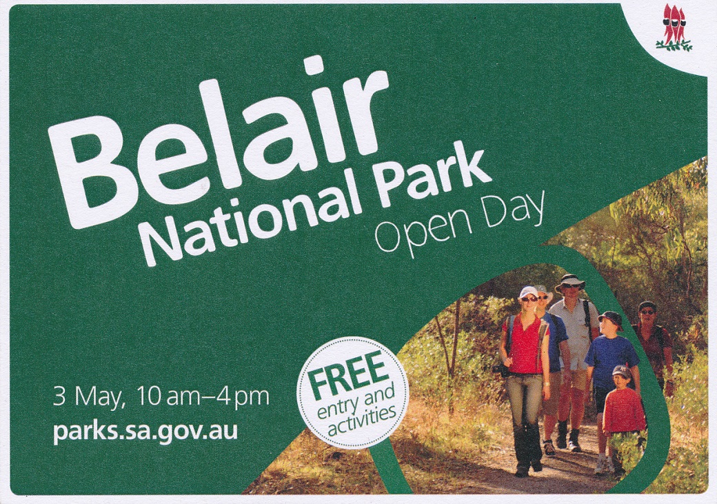
Belair National Park Open Day invitation
I decided I would activate the Park for Open Day as I thought this would be a great chance to profile our wonderful hobby. I spoke with the Ranger and she knew my plans. I kept away from the popular areas as the noise level was likely to be higher and I didn’t want my signal relayed over the public address systems.
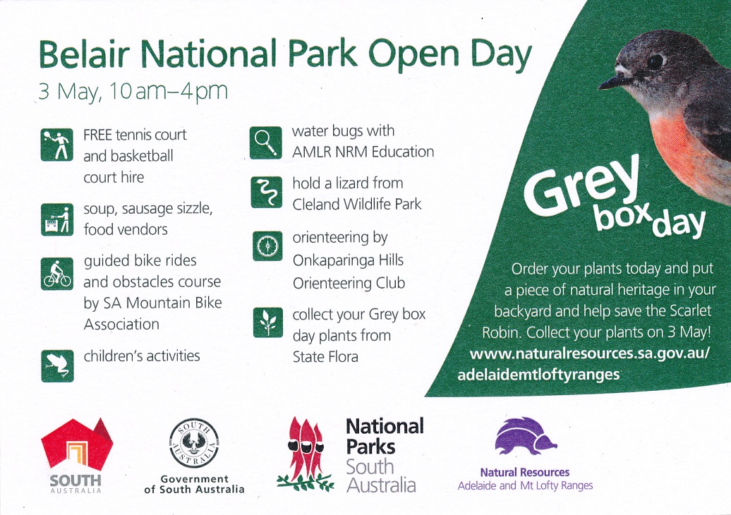
Belair Open Day
reverse
I had contacts on 40 and 30 metres, I tried 17 and 10, and although I could hear signals, I didn’t think I could work them. Thirty metres was great with strong signals from interstate, including Mike, VK6MB, from Western Australia. Fifty-nine contacts were made over the activation and as well I conducted some antenna experiments. Contacts were had from VKs 1,2,3,5, 6, and 7.
I decided to return to Long Gully, my third visit at this picnic area within the Park. I set up in the usual fashion taking advantage of the Park picnic table and my 20 and 40 metre well-used linked dipole. I soon noticed I was getting poor reports and after three contacts decided to change antennas. I am not sure what the problem was. I changed the coaxial feeder to no avail and made sure all of the connectors were tight. I did notice that some connectors do not screw onto the FT897 SO239 socket as well as they should. Perhaps the SO239 is worn?
Here are my first three contacts for 40 metres beginning at 2306: VK5PAS/P, Paul 59s 58r from Murray Sunset National Park, VKFF- 373; VK5FANA, Adrian, 57s 56r; and finally, Fred, VK3DAC, s57 r41. I then changed antennas to my new home brew three band antenna for 30, 17 and 10 metres. I have operated before on 30m QRP with an end fed half wave length antenna and had success from Spring Gully Conservation Park, near Clare. I was really pleased with the 30m contacts:
00:09 VK3PF/QRP, s57 r 54
00:13 VK5EE s59 r57
00:14 VK7CC s59 r58
00:16 VK2IO s57 r54
00:22 VK1DA/P1, s59 r57, Andrew was on VK1/AC- 034. Andrew saw my spot on Parks and Peaks and made a special excursion to 30m to give me a call. This was greatly appreciated.
00:29 VK2YW 259 r59
00:31 VK6MB, s58 r46
00:34 VK3OF, s59 r59
I checked, in order, 17 metres and then 10 metres. I did hear signals but not strong on either band and I did call CQ on each band. I then decided to change antennas and I used my SOTA antenna (20 and 40m), which I have owned for two years, for the first time!
Beginning at 01:31, on 40m, VK5PAS/P, Murray Sunset National Park; VK5LY, Larry; VK5ZAR, Arno; VK5C/P on SOTA summit, VK5/SE-007; VK5PAS/M; VK5NAL; VK3FQSO; VK3OHM; VK5NQP; VK3HSR; VK5FLEX; VK5GT; VK5WG; VK5NAQ; VK5KLV; VK5FTRG/M; VK3TKK; VK100ANZAC from the Mentone RSL; VK5HSX/P5, Stef in Hallett Cove Conservation Park; VK5ZGY/M; VK5FCGM; VK3UP/P3; VK3PMG/P3, Mick in Kara Kara National Park, KFF-629; VK3ATC; VK3CRG; VK3YE/P, Peter at Chelsea Beach; VK5FTVR; VK3SFG/P; VK5KC; VK5VGC; VK5MJ; VK5PAS/P5, Paul in Murray River National Park, VKFF-372; VK5JK; VK5KFB; VK3BWZ; VK3YAR; VK3AWG; VK3MPM; VK5PAS/P5; and finally, to finish a great day, Larry, VK5LY/P in the Murray River National Park, VKFF-372. My original plan was to activate Mark Oliphant Conservation Park VKFF-782 to begin my campaign for 44 contacts. However, upon learning of the Open Day at Belair National Park, I changed my plans. I listened on the frequency I was using to work Larry and then suggested he should remain there. As soon as Larry called CQ he was greeted with a pile up. How great was that! My log has been uploaded to HRD.log and Log Book of the World. Thanks to all who gave me a call.
The Park
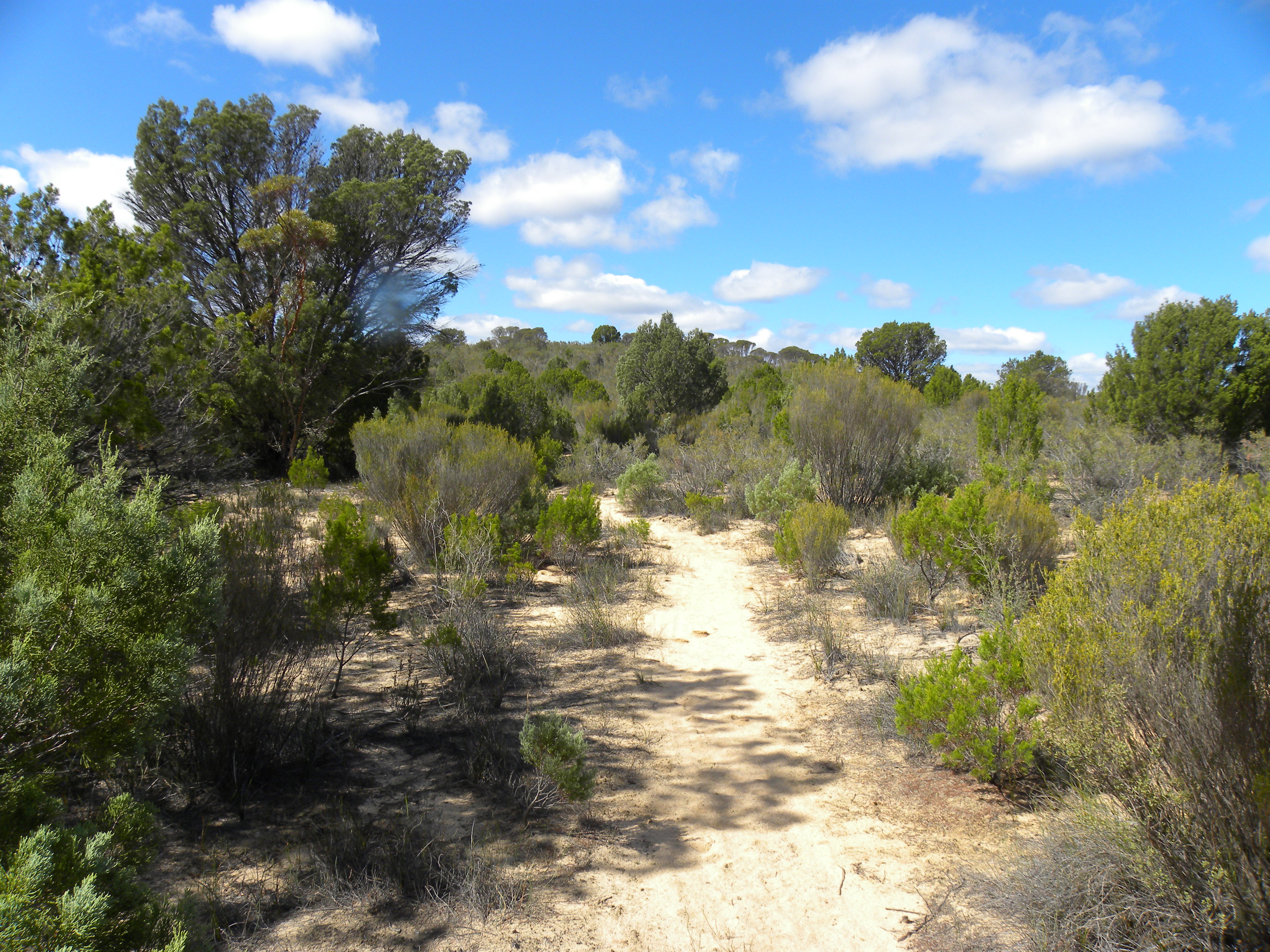
Ngarkat Conservation Park was proclaimed in 1979 and is one of the largest Mallee Parks in South Australia. It is 270,000 hectares of vegetated sand dunes mallee and heath. It was originally a pastoral lease in the 19th century.
Ngarkat Conservation Park JCD Photo
Activation
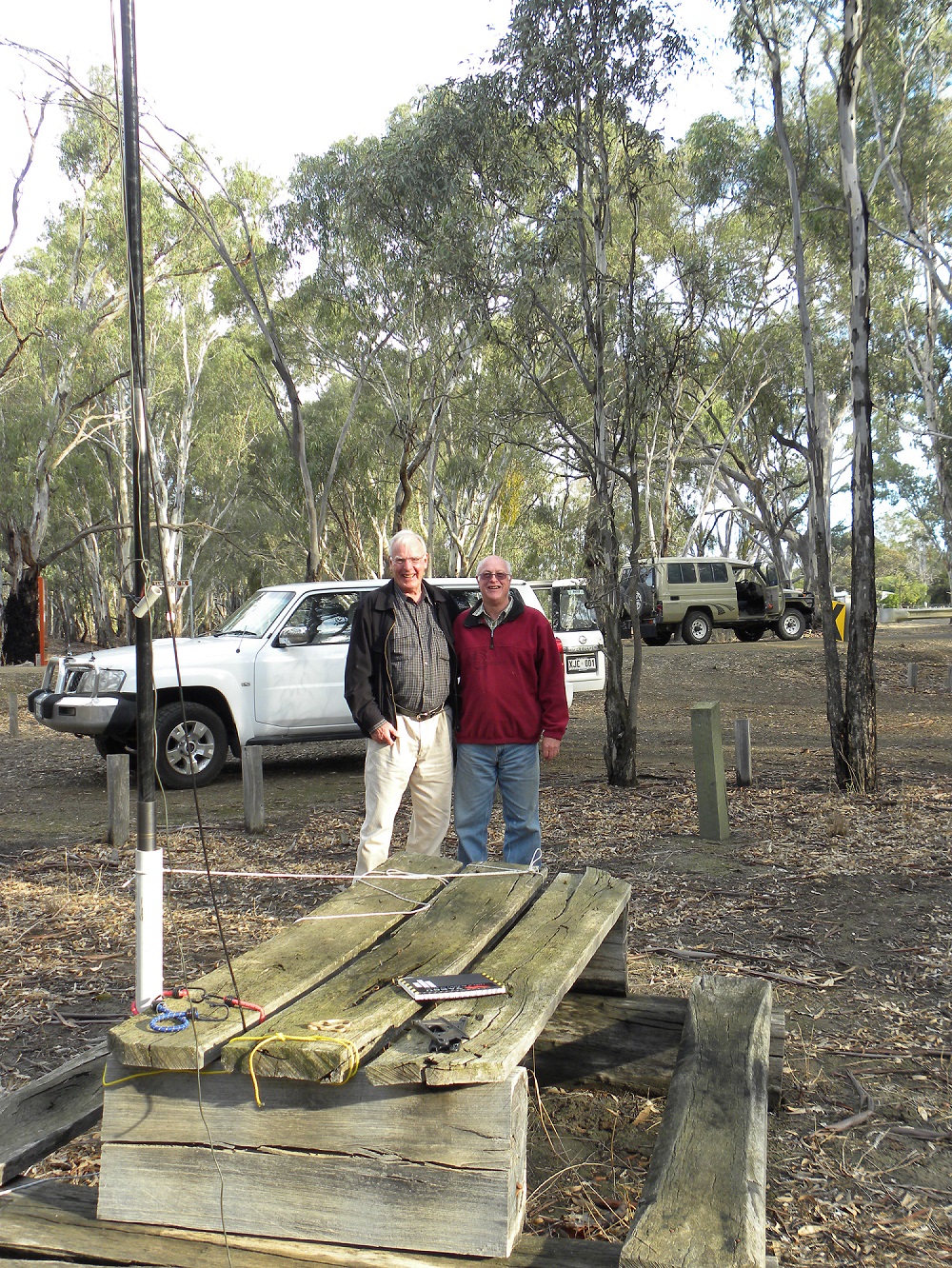
Today, after some very small amount of persuasion from VK5PAS, Paul, I decided to detour to Ngarkat Conservation Park, VKFF-829, just south on Pinnaroo. After spending the night in Ouyen, Victoria, we made our way to the Victorian/South Australian border and just a few moments later arrived in Pinnaroo. It was a cool morning, but the sun was shining. I thought a coffee was in order. I was sitting in the bakery (no I was not eating cream buns) quietly enjoying my coffee. Suddenly my phone almost jumped off the table! I received a text message from Paul. He was asking whether I was considering a further activation. I wasn’t all that keen. I texted back and said I could be persuaded. That was enough. Paul phoned me back. We were laughing and talking and I thought I might be arrested for disturbing the peace in the bakery. I do, after all, have a substantial voice! However, I survived!
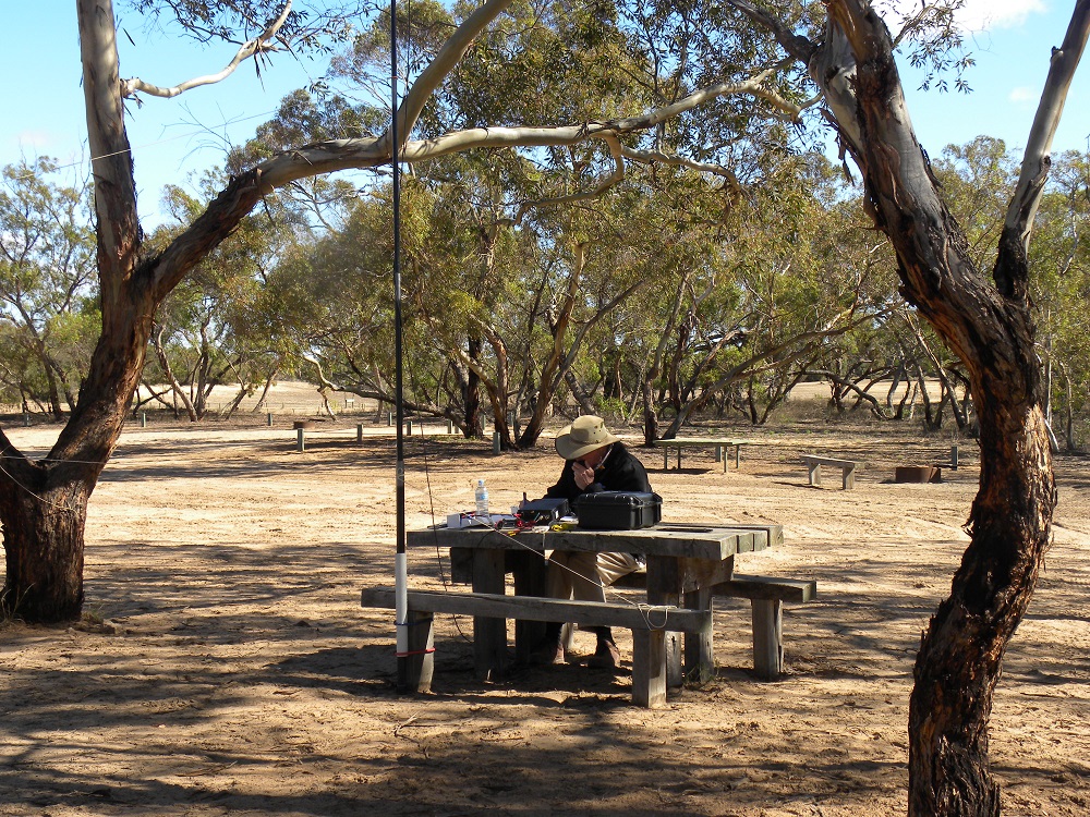
VK5BJE at Ngarkat CP
JCD Photo
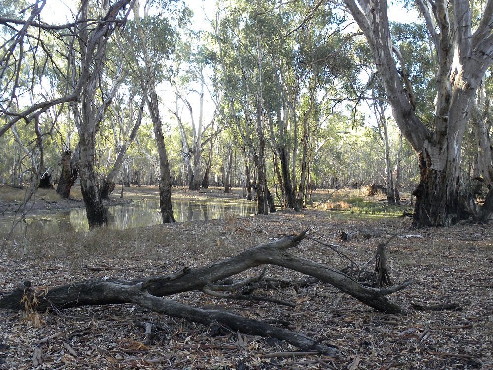
After coffee we left Pinnaroo and soon were tracking down Rosy Pine Road towards the Park. We thought we would enter the Park at Pine Hut Soak, where there is a camp ground. The place was deserted. And it was just beautiful: typical Mallee country, sand, little understory but well-developed Mallee scrub. The camp is at the start of the famous Border Track. I had not driven this track, which despite the rain, was open. It would be foolhardy to be tempted with just a single vehicle.
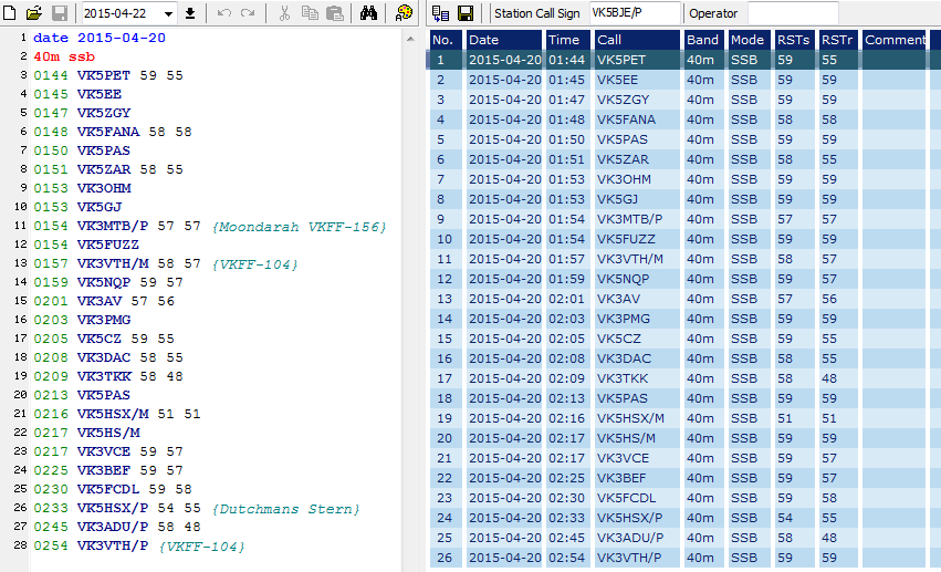
I was on the air on 40 metres at 01:44 and my last contact was at 02:54. In just over an hour I enjoyed 28 contacts. I have sufficient investment in the Park to return to build up my contacts 44.
References
Finally, for those interested in the Mallee Parks of Victoria and South Australia you might find this publication of interest.
Nicholls, G. & Angel, A, n.d. circa post 2002, Mallee Tracks: A Wanderer’s Guide to the South Australian and Victorian Mallee, self-published, Pinnaroo.
My wife purchased her copy a few years ago and she saw an advertisement for the book at Pinnaroo so it is still available. An internet search might turn up some copies.
Another useful publication from our archives is:
Tracks of the Mallee, 2008, Department of Environment and Heritage, Government of South Australia
This publication provides many interesting details of all of the SA Mallee parks, including maps, tracks and historic sites. A more up to date version is available for download from the Department’s website.
Log
Here is my log in Fast Log Entry. This approach saves many, many keystrokes!
Ngarkat log
Fast Log Entry
Click log to expand.
The Park
I have been to this Park before on a more appropriate day as far as the weather was concerned. Here is the link to that activation https://vk5bje.com/2013/12/22/terrick-terrick-national-park-victoria-22nd-december-2013/
Contacts
On Sunday morning we left Echuca for Terrick Terrick National Park, VKFF-630, about three-quarters of an hour’s drive. We have been to Terrick Terrick National Park before and I secured 12 contacts. My aim was to complete the activation by gaining a further 32 contacts to make the 44 required for the WWFF award. It was cold. The air-stream moving over South East Australia has given us our first taste of winter. While the sun was shining the wind chill was quite severe. I was able to gain 48 contacts using both 40 and 20 metres. The action began at 00:27 with a contact with VK5PAS/P5, Paul at Maize Island Conservation Park, VKFF-827. Signals were 5 and 9 both ways. The band appeared to be in great shape. I worked VKs1, 2, 3, 5, 6 and 7. My last contact was with VK7DR, Rob, at 02:22. Rob is located in Oldina, a small town south of Wynyard on the North West coast of Tasmania. My station was a FT897 set for 10 watts, a 40/20 metre linked dipole and a 8.400 amp hour LiFePO4 battery.
Here are my contacts in order beginning at 00:27
VK5PAS/P5, Paul, Maize Island Conservation Park, VKFF-630
VK5FANA, Adrian
VK3PF, Peter
VK5ZAR, Arno
VK5FMID, Brian
VK3TKK/M, Peter
VK3OF, Rex
VK5EE, Tom
VK1MA, Matt
VK3DAC, Fred
VK3VZX, Dale
VK5TN, Robin
VK5ZGY, Greg
VK5NRG, Roy
VK3VTH/M, Tony
VK5AV, Tim
VK3AFW, Ron
VK3MKM, Ken
VK3AV, Bernard
VK5WG, Nev
VK5TRN, Tony
VK5FTRG, Tom
VK3KAI, Peter
VK3KAB, Kevin
VK3BBB, Brian
VK3KKP/P3 Tony
VK3XL, Mike
VK3UP, Terry
VK2HFS, Frank
VK3YDN, John
VK2KYO, Ken
VK5CZ/P3 Ian, Mt Remarkable National Park, VKFF- & SOTA VK5/NE- 055
VK3CAT/P3, Tony, Mt Macedon, VK3/VC-007
14.305, VK2FX, Kees
7.100, VK3VCE, Dave
VK7NWT, Scotty
VK5MJ, Mal
VK5NQP, David
VK7VDL, Ron
7.150, VK7DR. Rob, Oldina South of Wynyard on the North West Coast of Tasmania
Thank you to all of you who helped me get 40 contacts, which with 12 from an earlier activation, more than allows me to qualify the Park.
The Park
I have activated the Park before. Here is a link to that activation.
Barmah National Park near my activation spot
JCD photo
Current Activation
We arrived in Echuca at about 3.15pm, secured accommodation and then decided it was too late to drive to Terrick Terrick National Park for a second visit. So we went back to the Barmah National Park and I began to set up just inside the Park boundary not far from where the Kingfisher Cruises leave. I decided to use a picnic table as the point for setting up my station. As I was doing this a 4 x 4 came along on the trip out from the Park. The driver pulled up in a hurry. A tall man with hair the same colour as mine got out. He had a wide grin on his face and came marching over. I soon realised it was Tony, VK3VTH/P3. Tony told me he had been in the Park and successfully activated it with 66 contacts including some DX. What a great experience. We chatted for about 15 minutes before he had to leave for his campsite. Tony and I tried, unsuccessfully to meet in the Brisbane Ranges National Park. I am sure pleased we were more successful this time. I asked him what made him decide to stop. He said he saw my squid-pole.
Tony, VK3VTH & John, VK5BJE/P3 in Barmah National Park JCD photo
I quickly gained 15 contacts, including two on 20 metres one of which was a DX station, YJ8RN, Rob.
Beginning at o6:28 I had contacts with in order on 7.095: VK5ADL, David; VK5FD/M, Allan; VK5KBJ, Barry; VK5KLV, Les; VK3PF/QRP, Peter; VK3ZPF, Peter; VK5PET, Peter; VK2YW, John; VK3DBP, Paul; VK5YX, Hans; VK5ZGY, Greg; VK3HRA, Allen; VK2FBBB, Rob; on 14.300 Mhz, VK3FD/6 QRP and finally at 07:13, on 14.296, YJ8RN/P, Rod, at Loh Island, OC-110 in the Torres Group Vanuatu. While I have activated Barmah National Park before it was not then registered for the WWFF award. I was very pleased to secure 15 contacts for a spur of the moment activation. Thanks to all who gave me a call.
The Park
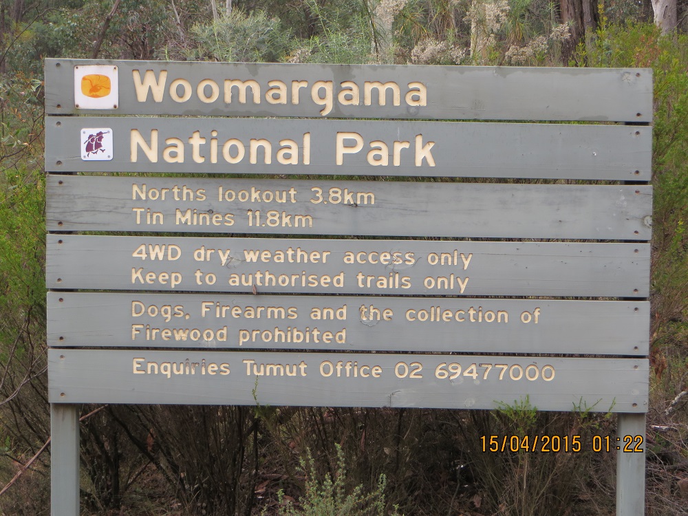
Woomargama National Park is about 30 kilometres north east of Albury. The Park is the largest protected area west of the Great Dividing Range and is renowned for the largest remnant box woodlands on the South West Slopes. Parts of the reserve are near 1000 metres above sea level and the Norths Lookout, where I operated on the 15th, is one such location.
The views were stunning. The excellent Park brochure indicates that the Park provides well-marked public access trails and opportunities for off-road driving. The 3.8k track from the edge of the private pine forrest to Norths Lookout was of intermediate 4 x 4 standard, probably because of the rocky areas and drop-offs on the track. I bottomed the Patrol at one point. The track can be navigated by ‘capable off-road vehicles’. High clearance is necessary and the tracks would be slippery today (17th April 2015).
Woomargama NP track maker at 3.8k mark
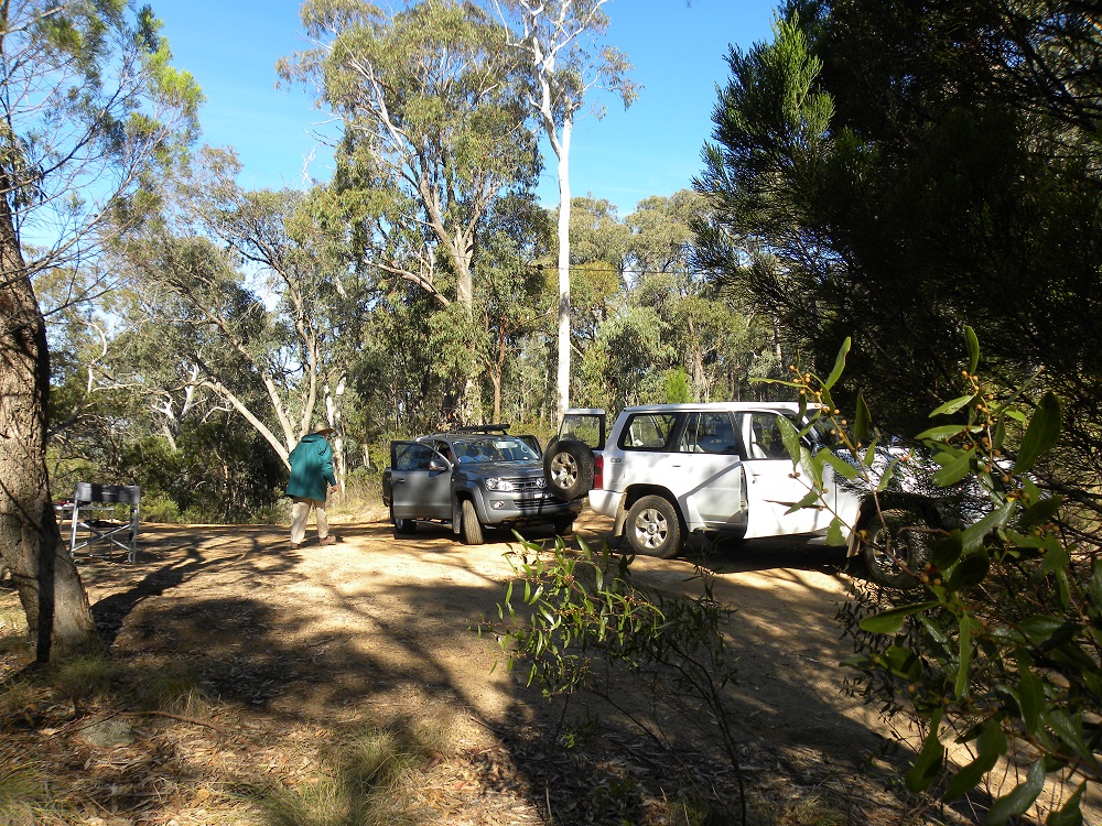
My activation spot and vehicles at Norths Lookout: JCD photo

Norths Lookout
To visit the Park we stayed at the Great Aussie Holiday Park located at 14 Hore Road, Bowna. It is a great spot whether you want an unpowered tent site, a powered site or wish to live in ‘luxury’ in a cabin. There are plenty of activies for small people as well.
Access
The brochure indicates that access to the western side of the Park can be gained via Tunnel Road. That was the approach we took today for our second activation (17th April 2015). But on our first visit we left our camp and took the River Road from Wymah Road, and turned on to Tunnel Road from the Eastern end drove to the Samuel Bollard Camping area. Then we took Tin Mines Trail through the Park, then through the private pine forrest before reaching the Park boundary and taking the 3.8k 4 x 4 track to Norths Lookout. Here is the map of the Park from the Government brochure. The two approaches we took are clearly visible as is Norths Lookout.
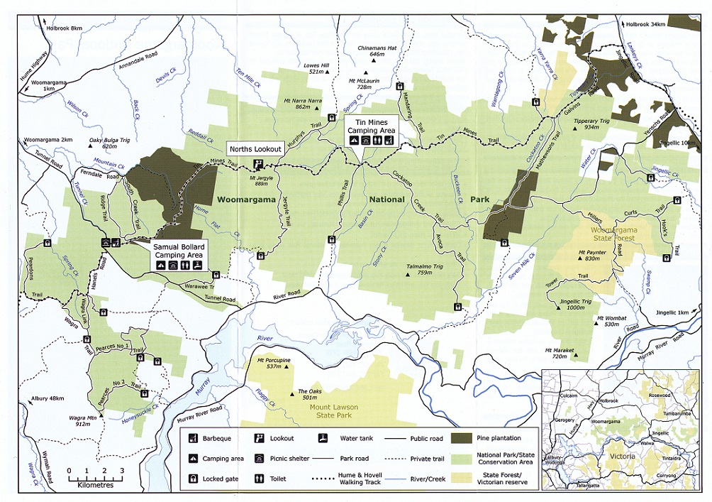
Woomargama National Park courtesy Department of Environment and Climate Change NSW
Contacts I was able to secure 22 contacts on the first activation (15th April 2015) and 28 on my second activation (17th April 2015). I am delighted to gain my required 44 contacts for this Park, the first New South Wales Park where I have managed to jump the hurdle. I appreciate the chasers who made the effort to give me a call. I always appreciate the callers. 15/04/2015 7.080 VK5EE/P5, 02:49, s59 r51, Tom; VK2JDL/P2, 02:53, s57 r59, VK2/IL-004, Phil; 7.095 VK3HRA, 03:00, s59 r55, Allan; VK2IO, 03:01, s58 r43, Gerard; VK3OF, 03:03, s59 r58 Rex; VK3FQSO, 03:08, 58 54 Amanda; VK3TKK/M, 03:09, s57 r55, Peter; 7.080 VK3EQ/P3, 03:24, s58 r58, VK3/VE-014, The Horn, Mt Buffalo National Park; 7.090 VK5PXO s58 r53, 03:36, Les at Millicent; VK3NBL, 03:35, s56 r59; VK5NIG/QRP, 03:48, s51 r51, Nigel; VK2FABE, 03:49, s59 r57, Gary; VK5ZLT, 03:56, s59 r57, Allan, Bordertown; VK3DAC, 04:02, s59 r58, Fred; VK3LSD, 04:06, s59 r58, Les; VK3FOWL, 04:09, s53 r57, Julie; VK3NBL, 04:13, s59 r57, Ray at Melton; VK5IS, 04:21, s55 r54, Ian; VK3PF, 04:28, s59 r 58, Peter; VK3OHM, 04:29, s59 r59, Marc; VK2FMIA, 04:31, s52 r22, Doug; 7.090 VK2FADV, 0433, s57 r 58, Jim, Blaxland. This activation resulted in 22 contacts with one duplicate. My operating conditions were an FT897 set at 10 watts, 8.4 MAh LiFePO4 battery and a home brew 20/40m dipole.
17/04/2015
On the 17th April 2015, on a very wet morning, we left our camp and took the roads to the Hume Highway and then travelled north to Woomargama township. There we took a right hand turn to Tunnel Road and we drove until the Park was on both sides of the road, clearly visible on the map, and found a spot to set up my station. It was not a cold day but it was wet. 7.090 VK2UH, 00:16, S59 r59, Andrew; VK2JCC/P2, 00:26, s56 r56, Colin; VK5PAS, 00:38, s58 r55, Paul; VK5HCF, 00:40, s55 r55, Col; VK2FADV, 00:42, s53 r58, Jim, Blaxland; VK2BMU, 04:44, s59 r58, Bob, North Kellyville; VK3ANL, 00:48, s57 r58. Nick; VK2XJS, 00:50, s58 r41, Julian, Oberon; VK2XAM, 00:53, s52 r53, Max QRP; VK3PMG, 01:00, s57 r58, Mick; VK5FAKV, 01:04, s58 r59, Shawn; VK7VDL, 01:07, s55 r51, Ron; VK3PTL, 01:09, s58 r57, Ian; VK3AXH, 01:11, s59 r 57, Ian, Ballarat; VK3ARR, 01:13, s54 r59, Andrew; VK2HPN, 01:18, s55 r57, Phil, Bredbo; VK2FAJF, 01:23, s57 r59, Steve; VK5HS, 01:26, s56 r55, Ivan; VK5FAJS, 01:28, s52 r55, Alan, Mt Gambier; VK5TA, 01:30, s53 r57, Tom; VK3FQSO, 01:31, s53 r56, Amanda; VK2MTC, 01:35, s59 r58, Greg, Cooma; VK5FMID, 01:40, s57 r57, Brian; VK3HRA, 01:42, s59 r56, Allan; VK3KAI/M, 01:44, s52 r45, Peter; VK3FPSR, 01:46, s59 r57, Peter; VK3OHM, 01:47, s59 r59, Marc; VK7VDL, 01:49, s43 r54, Bob. I enjoyed my visit to this spendid park and commend it to you, especially the VK1 and VK2 amateurs who live nearby. I wish to thank all of those amateurs who gave me a call. It is always appreciated.
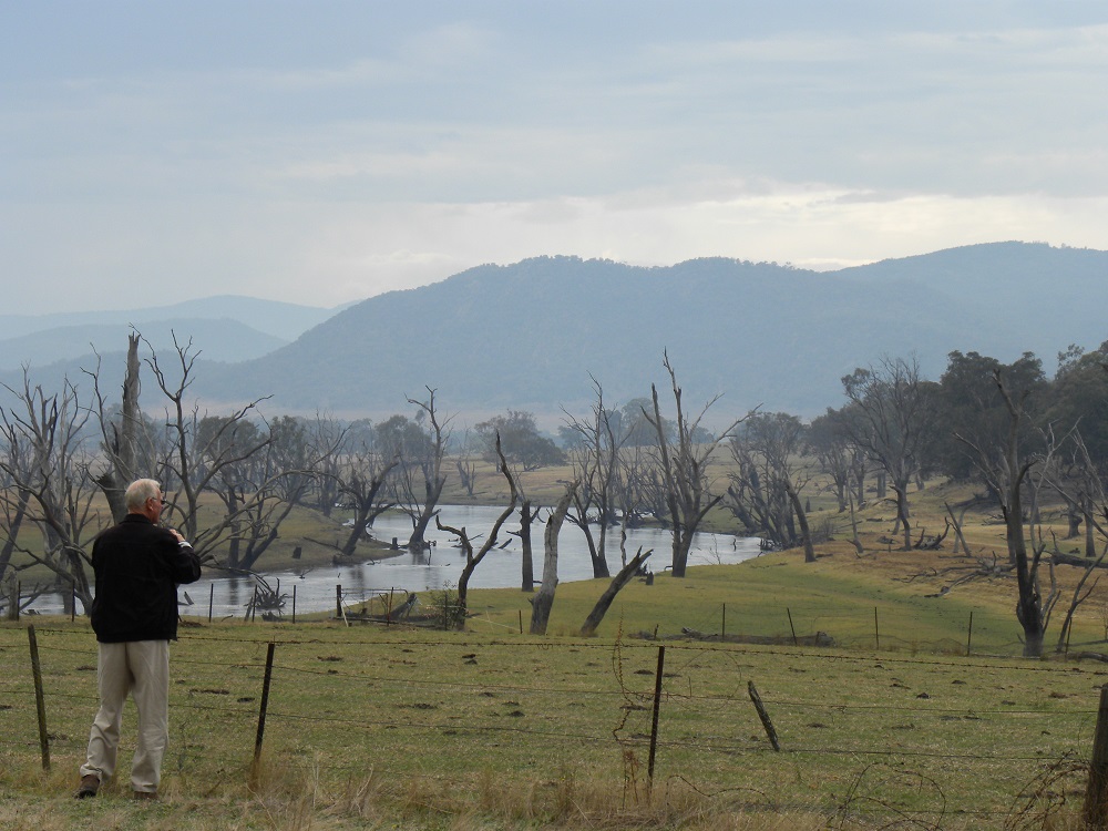
The Murray River from River Road: JCD photo
