Lake Eildon National Park, VKFF-625

We left Mount Skene and travelled to Lake Eildon and decided to take the Jamieson to Alexandra road and arrived at the Lookout Point in Lake Eildon National Park. On my Rooftop’s Map it is named Williams Lookout. At this point, about six kilometres past the turnoff, there is a great view of the upper reaches of Lake Eildon. It is spectacular.

I set up and checked the frequency at 7.090 and then gave a call at 05:19. Twelve contacts later at 05:57 it was time to pack up and head for Seymour. I spoke with VK5LY, Larry;  VK3FQSO, Amanda; VK3FLAK, Bob; VK2AMA, Ross; VK2KVH, Victor; VK3NBC, Rob; VK5HS, Ivan; VK2CCW, Michael; VK5MBD, Bill; VK5FGRY, Gary in Morialta Conservation Park, VK7ZGK, Graham from Hobart and finally at 05:57, VK7KEV, Kev from Wynyard.

Lake Eildon National Park from Lookout

Lake Eildon National Park from Lookout

I decided to pack up as we had to drive to Seymour. I was sorry we didn’t have more time to explore Lake Eildon National Park.  It would be a great place to camp for a week and explore.

Mount Skene, Sota Summit VK3 VE 031, 28th April 2014

After some encouragement from VK3PF, Peter, I decided to activate Mount Skene VK3 VE 031. We left Bairnsdale at 08:00 and arrived at Mount Skene at about 12:00 noon. We enjoyed the drive. Licola is pretty much as we remembered it. The road is gravel a few kilometres after leaving Licola and returns to a sealed tarmac just before Jamieson. We saw only four vehicles on the road after Licola. There are a few pot holes and the usual corrugations on corners. The road is two-wheel drive capable providing care is taken. Travelling slowly and picking your path is the key to success. Some kind person had recently cleared a break through a fallen tree.

Tree over road between Licola and Mt Skene

Tree over road between Licola and Mt Skene JCD photo

It is an easy summit. You only have to walk from the parking area to the summit and carry your gear about 200 metres. The trig point is in great condition and make sure you read the plaque under the trig point. The altitude is given as 1551 metres. The old track is just visible, but if you look for two large rocks put in place by the authorities to stop vehicles going off road, you will see the track.

Mount Skene summit track JCD photo

Mount Skene summit track JCD photo

After setting up at the summit, 13 contacts were enjoyed. I am really appreciative of those who gave me a call, given that most of the regulars were probably back at work. The first contact was at 02:17 UTC and the last at 02:58.  At 02:17 I worked VK3FQSO, Amanda; VK3YN, Mark at Bendigo; VK2JNG/P2, Gerard QRP; VK3UH, Ken; VK2IO, Gerard; VK2AMI, Ross; VK5HS, Ivan; VK2UH, Andrew; VK3AFW, Ron; VK1MBE, Andrew; VK5LY, Larry; VK3XD, John and at 02:58, VK3YN, Mark.

The first picture shows me kneeling on a rug and operating the FT817. While I had my rain coat on and there were a few spots it was not really cold. My nine metre squid pole is inserted into a tube and tied to a stump. Power for the five watt radio was supplied from a 4.2 amp hour LiFePO4 four cell battery.

VK5BJE at Mt Skene

VK5BJE at Mt Skene JCD Photo

FT817 and 4.2 Amp hour LiFePO4 battery

FT817 and 4.2 Amp hour LiFePO4 battery

Mitchell River National Park, 27th April 2014, VKFF-321

The Den of Nargun - Mitchell River NP

The Den of Nargun – Mitchell River NP

By the time we arrived at Mitchell River National Park it was getting pretty late in the afternoon. The Picnic area at the beginning of the
Den of Nargun walk was our selected spot within the Park and my wife decided to take the walk to the Den. It is supposed to take 15 minutes down and 20 back, but she raced back in 15 minutes because she thought I would be getting worried about her because it was close to sunset. Unfortunately, she found me completely engrossed in working many qsos!  I enjoyed thirteen contacts from 06:26 to 07:15. My first contact was with VK2TWR, Rod; VK2LAX, Rod; VK3TKK, Peter; VK3MEG, Steve; VK2JDS, Dave; VK5PAS/P5, Paul at Mt Gawler, VK5 SE 013; VK7EPF, Ray at Hobart; VK3GHZ/P3, Rhett at Wilsons Promontory National Park; VK5AV, Tim; VK5FBAA, Rod;  VK3FQSO, Amanda; VK3FMCR, Clive and VK2ZUH, John at 07:15.

The Lakes National Park, 27th April 2014, VKFF-484

The Lakes National Park

The Lakes National Park

We visited The Lakes National Park today. It was quite a drive from Orbost and I wish to apologise for those who were listening before 12:00 noon local time. However, I was on the air from 02:39 to 03:54 UTC and secured 22 contacts. It is a beautiful park and I appreciated the calls.

I used my ‘new’ FT897D set for ten watts and my home brew linked dipole. We found a great spot at a day visit area and there were no visitors except us. My spot was about 50 metres from the lake-side beach. It was about four kilometres into the Park. This is one area of Victoria where we had not been before. It was an idyllic spot.

At 02:39 my first contact was with VK3FB/P3, Len; VK3BHR, Phil; VK1GG/M, Chris with a strong signal; VK3ZLD, QRP, Louis; VK3PF/P3, Peter at French Island National Park, a new park for me; VK5FCDL, Col;  VK5PAS/M5, Paul; VK3JM, Fred; VK3CBV, Brenton; VK2LAX, Rod; VK3VCE, Dave; VK3UH, Ken; VK2HRX, Compton; VK7FMPR, Mark; VK3TKK, Peter; VK3YSP/P3, Joe an Julie at the antenna proving ground (a small park in Oakleigh); VK3FOWL/P3, Julie; VK3ERW/M, Erwin; VK3MMX, QRP, DarrenVK2JCC/P2, Colin at Sydney Heads, a scenic location but not a Park; VK3ANL/P3, Nick at SOTA summit  VK3 VG 001 and finally, VK1MA/P2, Matt at VK2 ST 005.

A view of the Lake

A view of the Lake

IMG_0279

A Kookaburra at work - The Lakes NP JCD photo

A Kookaburra at work – The Lakes NP JCD photo

Errinundra National Park, 26th April 2014, VKFF158

The Welcome sign for Errinundra NP

The Welcome sign for Errinundra NP

Fourteen contacts from Errinundra National Park was a good indication that this park was on the wanted list for a number of amateurs. I was on the air at 02:55 and my last contact was at 04:04. Getting to Errinundra was a long drive and I wanted to get out of the park and arrive at our accommodation before darkness. The Park was badly damaged in the recent fires and I was doubtful I would find a reasonable activation spot.

Fire damage at Errinundra NP JCD photo

Fire damage at Errinundra NP JCD photo

Eventually we came to a sign indicating a walk through old growth forest. It was a small circular car park with some picnic spots. For most of the time we were the only people present. My first contact was with VK3MTB, Tim; VK3ZPF, Peter; VK3ANL, Nick at the Alpine National Park; VK3HRA, Allen; VK3FQSO, Amanda; VK3PF/P3, Peter who needed this Park to complete 45 as a chaser; VK5HCF, Col; VK3UH, Ken;  VK5HCF, Col; VK5AV, Tim; VK2HRX, Compton on VK2 CT 003; VK2UH, Andrew; VK3MRH, Ron and finally, VK1RAN, Rob in Canberra.

Old Growth Forest Walk

Old Growth Forest Walk

Lind National Park, 25th April 2014, VKFF-287

I activated Lind National Park early in the morning of the 26th April 2014 (UTC 25th April). I was able to catch up with my South Australian mates on 7.073 at 22:40. I exchanged signal reports with VK5ADL, David; VK5TW, Trevor; VK5ZK, Gary; VK5KGP, Graham, VK5TH/P5, Trevor (I gave Trevor 5 and 8 and he gave me 2 and 1: I reckon he should trade in his radio!) and finally, VK5ZTJ/P5, who was camping on the Yorke Peninsula. The worst report I received was 4 and 5 and my best was 5 and 9 (except from VK5TH/P5).

I then checked 7.100 and had the following contacts: VK3FQSO, Amanda; VK3HRA, Allen; VK2NNN, Darren; VK2CCJ, Cliff with a magnetic loop: his signal was 5 and 9 and he gave me 5 and 8); VK5AV, Tim; VK2LAX, Rod; VK5HOS, Owen; VK1DI, Ian; VK2KP, Ken, VK5ICP, Col and VK5ZPF, Peter, making 17 contacts.

Lind National Park, one of Victoria’s oldest is small, a mere 1,370 hectares.  The Parks Victoria brochure suggests this park has no facilities for visitors and the recommended way of seeing the park is to drive around the perimeter: Princes Highway – Combienbar Road and then Euchre Valley Scenic Drive. Unfortunately the Euchre Valley Scenic Drive is closed due to the failure of two bridges in the February 2014 fires.  However, great views of the dense rainforest can be seen on the left hand side of the Princes Highway driving towards Cann River,  but there are no places to stop on the Highway and it is very busy. I activated from a spot on the Combienbar Road almost as far as the turn at Club Terrace. There was a small clearing on the edge of the Park. It was not entirely satisfactory because there were logging trucks on the road. A line drawing of the park can be found in the Parks Victoria brochure available for download.

Alfred National Park, 25th April 2014, VKFF-618

Like Lind National Park there are no facilities for visitors at Alfred National Park. Parks Victoria suggest that glimpses may be gained of the park as you travel along the Princes Highway. The Department warns that there is no-where to stop and the highway is busy. We found that the road narrows every so slightly through this area as it travels through a cutting. Parks Victoria indicated that the Park has very high conservation value for both flora and fauna.  The line drawing map in the parks brochure for Croajingolong National Park shows both Lind and Alfred National Parks. If you check the map you will see that the West Wingan Road which we took to gain access to Croajingolong National Park passes by Alfred National Park and we found a great access spot at the southern corner of the Park. I was amazed at the dense nature of the temperate rain forest. You would need to take a compass and or GPS to venture more than a few metres into the Park.

Thanks to the ten amateurs who gave me a call at Alfred National Park, therefore ensuring a successful VKFF activation. My first contact was at 06:52 with VK3EK/P3, Robbie on SOTA summit VK3 VK 144;  VK3MRG/P3, Marshall at VK3 VN 030; VK5NIG/P5, Nigel in Wingfield Conservation Park; VK3FKSA, Banaar; VK2NNN, Darren; AX5PAS, Paul; VK2MCB, Philip; VK3FQSO, Amanda; VK3AMB, Bernard and finally, VK7HKN, Kevin near Launceston.

Alfred National Park

Alfred National Park

Croajingolong National Park, 25th April 2014, VKFF119

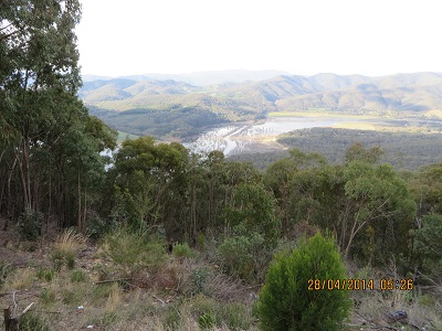
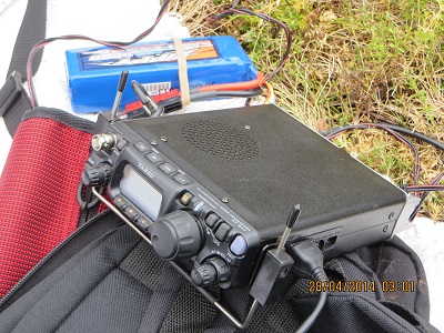
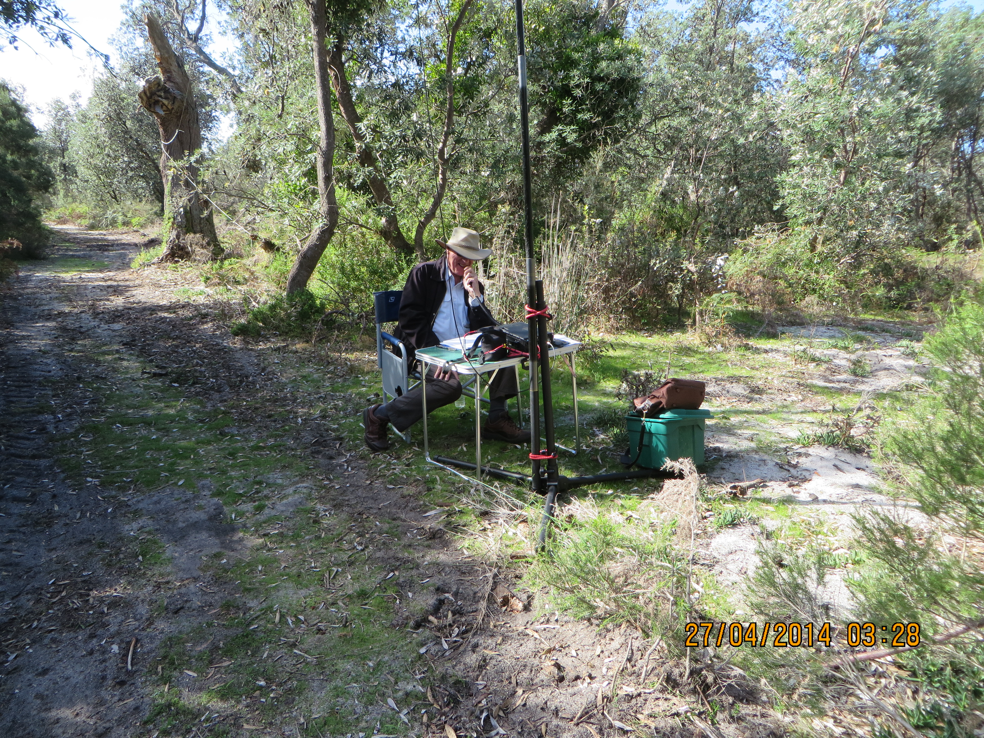
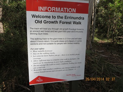
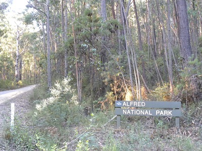
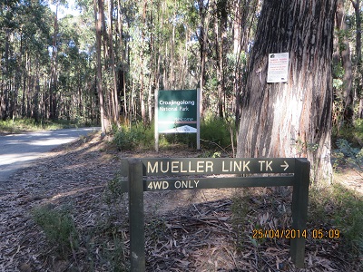
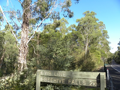
Croajingolong National Park covers a vast area from Sydenham Inlet to the New South Wales border. We visited the Park on Anzac Day and then we activated Alfred National Park. We had earlier in the day visited Coopracambra National Park on our way to Victoria from Narooma in New South Wales. We travelled the Monaro Highway to Cann River. It was a three park day! And very challenging. We chose to gain access to Croajingolong National Park via the West Wingam Road and soon after passing the park entrance we took the Meuller Track and set up on the edge of the track hoping no one would decide to visit!

Croajingolong NP, Meuller Track to 'shack'

Croajingolong NP, Meuller Track to ‘shack’

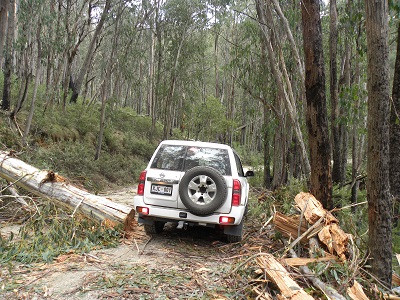
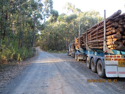
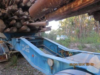
On our way along the West Wingam Road we were confronted by a person with a Stop Sign (or Lolly Pop). In conversation with this person it had transpired that the v-double log truck had lost its load on a wet and slippery corner. While the logs were not huge nor were they matches! I wouldn’t like to be on the receiving end of the load coming loose. We were able to continue on our way after a few minutes delay. The driver later told me that was why he was working on Anzac Day. The picture shows the log truck on our return from the Croajingolong activation parked near the corner of Alfred National Park. I was impressed with the driver. When he saw our 4 x 4 parked near the Alfred National Park corner he stopped his vehicle and came over to see all was right with us. He had earlier parked the log truck for departure on the 26th April.

The log-truck with the load on board

The log-truck with the load on board

Another view of the log-truck

Another view of the log-truck

As the Victorians will tell you these East Gippsland Parks are a long way from Melbourne and are not activated very often. In South Australia on 40 metres conditions are often poor and it is very difficult to copy QRP stations even from my home station where I experience very few problems with noise.  I am hoping some Victorians will feel inspired to travel to East Gippsland and activate these magnificent parks. I need them all as a chaser!

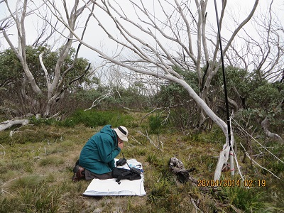
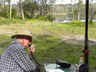
I began my efforts at 02:16 with a contact with VK3YY/P3, Glenn in VK3 VG 003, Mount Toorongo. What a great way to start the activation! Then followed VK3MTB, Tim; then VK3JNI, Philip at The Lakes National Park, VK3RAN, operator Luke; VK3PF/P3, Peter at VK3 VE 056; VK2IB/P3, Bernard at the same location as Peter; VK3FQSO, Amanda; VK3ZPF, Peter; VK2CCJ, Cliff; VK3ZPF, Peter; VK3BHR, Phil; VK3JD, John at Port Melbourne; AX2UH, Andrew at Yass; VK3MRG/P3, Marshall on VK3 VN 017; AX5PAS, Paul; AX2UH, Andrew; VK3FB/P, Len; VK3TKK, Peter; VK3HRA, Allen; VK3ANL, Nick on VK3 VE 019 and Mount Buffalo National Park, VK3MRO, Tibor; VK2LAX, Rod and, finally, AX2CL/P2, Raffy on Bear Island.  I was very pleased to achieve 23 contacts well and truly activating the park for the VKFF award.

Coopracambra National Park, 25th April 2014, VKFF-113

Today we returned to Victoria from Narooma in NSW. We took the Pacific Highway and not too far out of Bega turned right onto the Snowy Mountains Highway before turning South on the Monaro Highway and crossing into Victoria with the Park on the left hand side of the road. Not too far into Victoria we saw a sign giving access into the Park and indicating Beehive Falls about two kilometres further on. I found a good spot complete with picnic tables and no other homo sapiens. VK3PF, Peter, who has activated the Park twice recommended this spot. We had it to ourselves.

I set up and 23 contacts later packed up. I was really pleased with the activation. I used a new to me, but pre-loved Yaesu 897D, running about ten watts. I purchased this radio from a deceased estate in Sydney after seeing an advertisement in Amateur Radio Magazine for December/January. My son collected it about three weeks ago and this was the first time I had a chance to put it on the air. It will be used in the longer term at slightly higher power, say 30 to 40 watts, to give me a better chance of working DX from parks and giving chasers a better chance of hearing me from remote locations. I need to investigate a battery capable of supplying a higher current draw for a longer period if time, but still remaining ‘portable’. I will study the blogs of other amateurs to see what they use when using their FT897Ds on higher power in the field.

Beehive Falls turn-off at Coopracambra National Park

Beehive Falls turn-off at Coopracambra National Park

Here are my contacts: beginning at 02:16, VK3YY/P3, Glenn on VK3 VT 026; VK3MTB, Tim; VK3JNI/P, Tim at the Lakes National Park; VK3RAN, Tony; VK3PF/P3, Peter on VK3 VE 056; VK2IB/P3, Bernard also on VK3 VE 056; VK3FQSO, Amanda; VK3ZPF, Peter; VK2CCJ, Cliff; VK3ZPF, Peter; VK3BHR, Phil; VK3JD, John; AX2UH, Andrew; VK3MRG/P3, Marshall on VK3 VN 017; VK5PAS, Paul; AX2UH, Andrew; VK3FB/P3, Len; VK3TKK, Peter; VK3HRA, Allan; VK3ANL/P3, Nick on VK3 VE 039, The Hump, at Mount Buffalo National Park; VK3MRO, Tibor; VK2LAX, Rod and at 03:10, AX2CL/P2, operator Raffy at Club Station on Bear Island.

Eurobodalla National Park, 22nd April 2014, VKFF – 0164

I had a great time at Eurobodalla National Park just seven kilometres south of Narooma. I drove down a well-maintained track towards an inlet and while I was setting up a Sea Eagle flew circuits above me – I would like to think she/he was checking me out!  I was on the air at 00:56 and after checking the frequency called on 7.095 and was answered by VK2AFA/P2, Sam, on VK2/ CT – 002; then VK6MB/P2, Mike, as I have never heard him before barely a hop-step and jump away; VK5LY, Larry; VK5PAS, Paul; VK3PI, Mark; VK3UBY, Col; VK2LAX, Rod; VK2FW/P2, Ray; VK2CCJ, Cliff; VK3XL/P3, Mike, on SOTA summit VK3/ VC – 007 Mt Macedon; VK1MBE/P1, Andrew on VK1/ AC – 040 Mt Ainslee; VK1RX/P2, Al on VK2/ ST – 015; VK3AFW, Ron and VK3PF/3, Peter at 02:14 on VK3 /VG – 003. Fourteen contacts, some for a few minutes, has enabled me to qualify my first VK2 National Park for the VKFF award.

A view of Narooma near board-walk

A view of Narooma from board-walk

At Eurobodalla NP JCD photo

At Eurobodalla NP JCD photo

Eurobodalla National Park, of 3,069 hectares, on the far South Coast of New South Wales, has beaches, wetlands, spotted gum forests and a great home for water birds. It also contains significant Aboriginal and European cultural sites. While we have visited a number of National Parks in New South Wales this was the first time I really paid attention to the spotted gum.  These are magnificent trees.  I checked the NSW Government web pages for Parks and it indicates that there are close to 900 Parks and Reserves in that State. What a challenge for a Park activator!