The weekend beginning 13th May produced some really splendid Autumn days in Adelaide. I decided on Sunday that I would return to Mount George Conservation Park and try to complete my activation with 44 contacts thus qualifying the park for WWFF.
I had a most enjoyable activation with some action on 20 metres although no DX. I would need to stay on later in the afternoon to work Europeans and maybe US stations. My time endurance is limited by a medical condition! I am not growling, but just have to work within my limitations.
The weather has now changed back to cold and wet late Autumn and activation days will become less frequent.
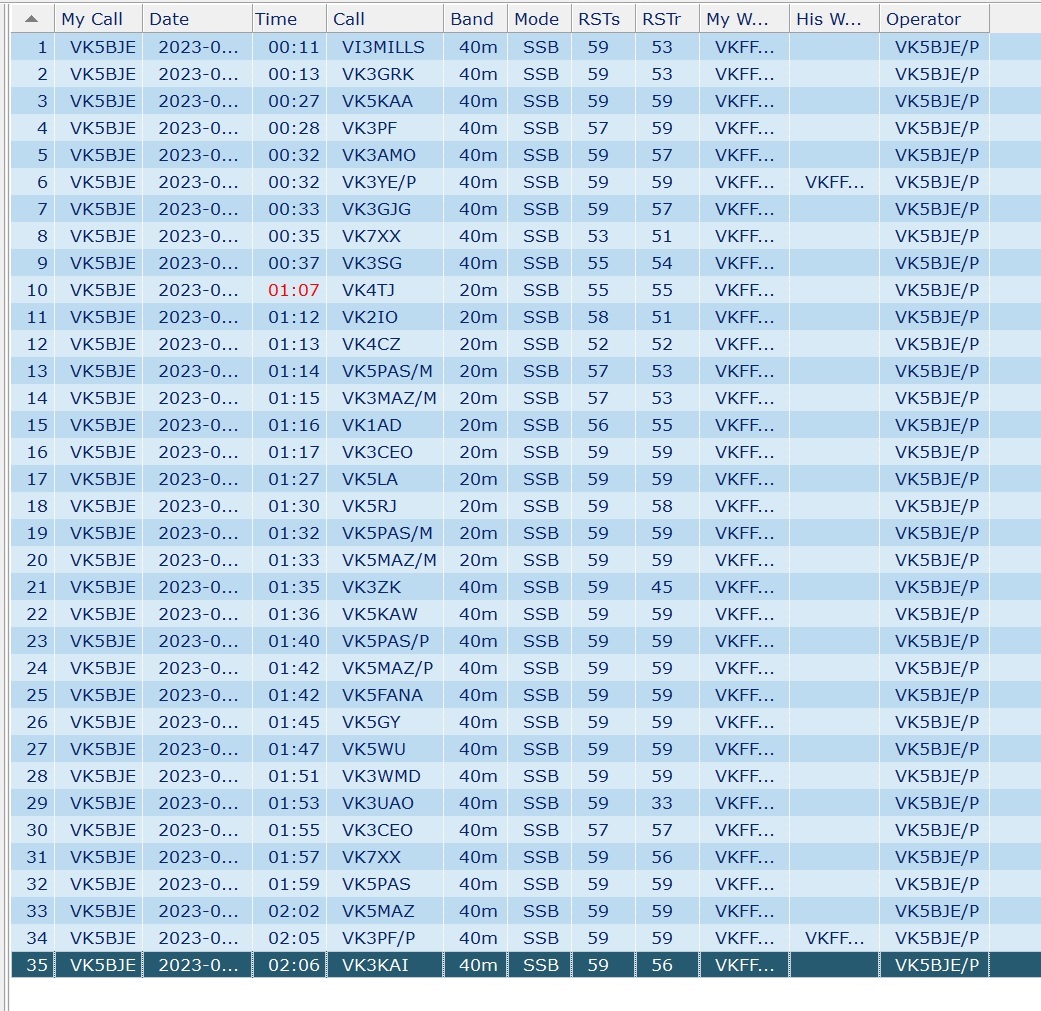
I have reproduced my log below (Fast Log Entry) and appreciate all of the calls, including two park to park contacts with VK3YE/P and VK3PF/P. I appreciate the contacts from all who chased me and those who worked me on two bands, and especially VK5PAS and VK5MAZ who contacted me while mobile, from a mill at Strathalbyn and from their home as well as on 40m and 20m.
Click on log to expand
The park adjoins the South Eastern Freeway and every time I visit the vehicle noise from the freeway is almost overwhelming. It is loud! But it soon disappears and fades into the background. No, this is not some new doppler-like effect! I am sure it is a result of my intense concentration on matters radio. I will return to the park as I want to activate the Mount Lofty parks near my home with cw mode contacts. I need the discipline of leaving the microphone at home!
Mount George Conservation Park has been on my to-visit list for a long time. It is nearly a decade since I last activated this park on the 4th August 2013. It was a mid-winter’s day but I succeeded in gaining 18 contacts before retreating to Barry’s house (VK5BW) to attend to my hypothermia with a cup of coffee. I did not give my post for 4th August 2013 a name, but it is accessible within this blog by clicking on the relevant date in the index of dates. And I did not upload my log to WWFF. I suspect that the activation was for the South Australian award (SANCPA), before WWFF began in Australia.
Contacts
7.160
05:48 Peter, VK3PF
06:06 VK3AMO Rob
06:02 VK5NPP, Phil
06{08 VK3ZPF Peter
06:08 VK5KAA, Gordon
06:10 VK3BBB, Brian
06:13 VK2CCP, Brian
06:13 VK5LA, Andy
06:13 VK3UAO, Stuart
06:14 VK5TN, Robin
06:16 VK3GJG, Garrick
06:17 VK5AYL, Sue
06:17 VK3ANL, Nick
06:18 VK5CZ , Ian
06:20 VK5IS, Ian
06:24 VK5UV, Rod
Sixteen contacts were enjoyed. Ah, the magic of radio!
The Tracks
‘There are other approaches to thinking about the ‘ways of the elders’ and my mind immediately focused on the first nations people of this continent and their ways, their tracks, their knowledge of how to get from a to b. I have been unable to find and references to the tracks in the Mylor Conservation Park and how they were formed, but I suspect they are more recent, that is, made by the first Europeans who settled here in 1836. But were their foundations laid down by earlier peoples? It is very likely and Grace Karskens, an historian, citing Sim (1966), a public servant, who stated ‘White men often built their roads along Aboriginal tracks, especially those following ridges1. She is writing about the peoples of the Hawkesbury River and gives many examples, familiar of course, to people living in that part on NSW.
In Adelaide the Pioneer Women’s Trail is 23.7 kilometres long and is rated as a hard walk. It dates from about 1840, and was used for about 30 years as a commercial route, walked by women and girls to take produce grown in the hills to the city for sale. Those heavily laden walkers began their walk about midnight 2.
The area traversed by the trail is divided by the ‘boundary’ between two Aboriginal groups:the Kaurna people who lived on the Adelaide plains and the Western side of the Mount Lofty Ranges and the Peramangk people whose lands extended from the Eastern side of the Mount Lofty Ranges to the Murray River. Some sources suggest the trails through Cleland National Park (Kaurna) and Mount George Conservation Park (Peramangk) are Aboriginal tracks 3′.
Karskens, G., 2020, People of the River: Lost Worlds of early Australia. Sydney. Allen & Unwin.
Steiner, M., 2000, Scott Creek: From Settlement to Conservation. Friends of Scott Creek Conservation Park. p. 7. See also Jones, Bevan, Participation Grows for Pioneer Women’s Walk. The Courier, Wednesday May 25th 2022.
Coles, R. & Hunter, R., 2010, The Ochre Warriers: Peramangk culture and rock art in the Adelaide Ranges. Stepney. Axiom Australia. See p. 13 for the map of the Mount Lofty Ranges showing the boundary of the Peramangk country and other local first nations.
Excerpt from Walking, 2022, John Dawes
The Park
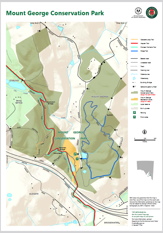
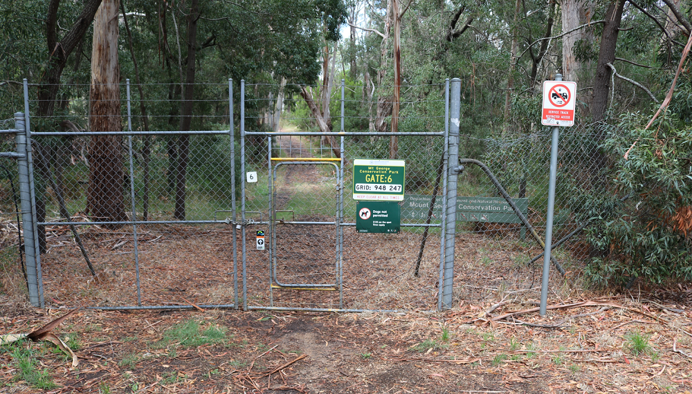
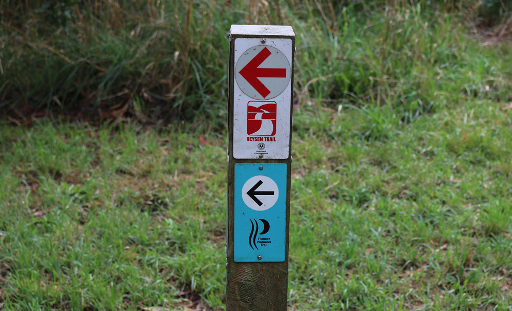
Mount George Conservation Park is one of the Mount Lofty Parks in the Adelaide Hills and is near Bridgewater and adjoins the South Eastern Freeway The map below, courtesy of the Department of Environment and Water, shows the park as two fingers of protected land with private property in between. The South Eastern Freeway is visible at the bottom of the map as are two parking signs. The background is a lighter colour and it is the picnic ground. It is part of the park and dogs are allowed here on leads. I activated within this area and there were very few people in the park. I spoke to one person who wanted to know what I was doing
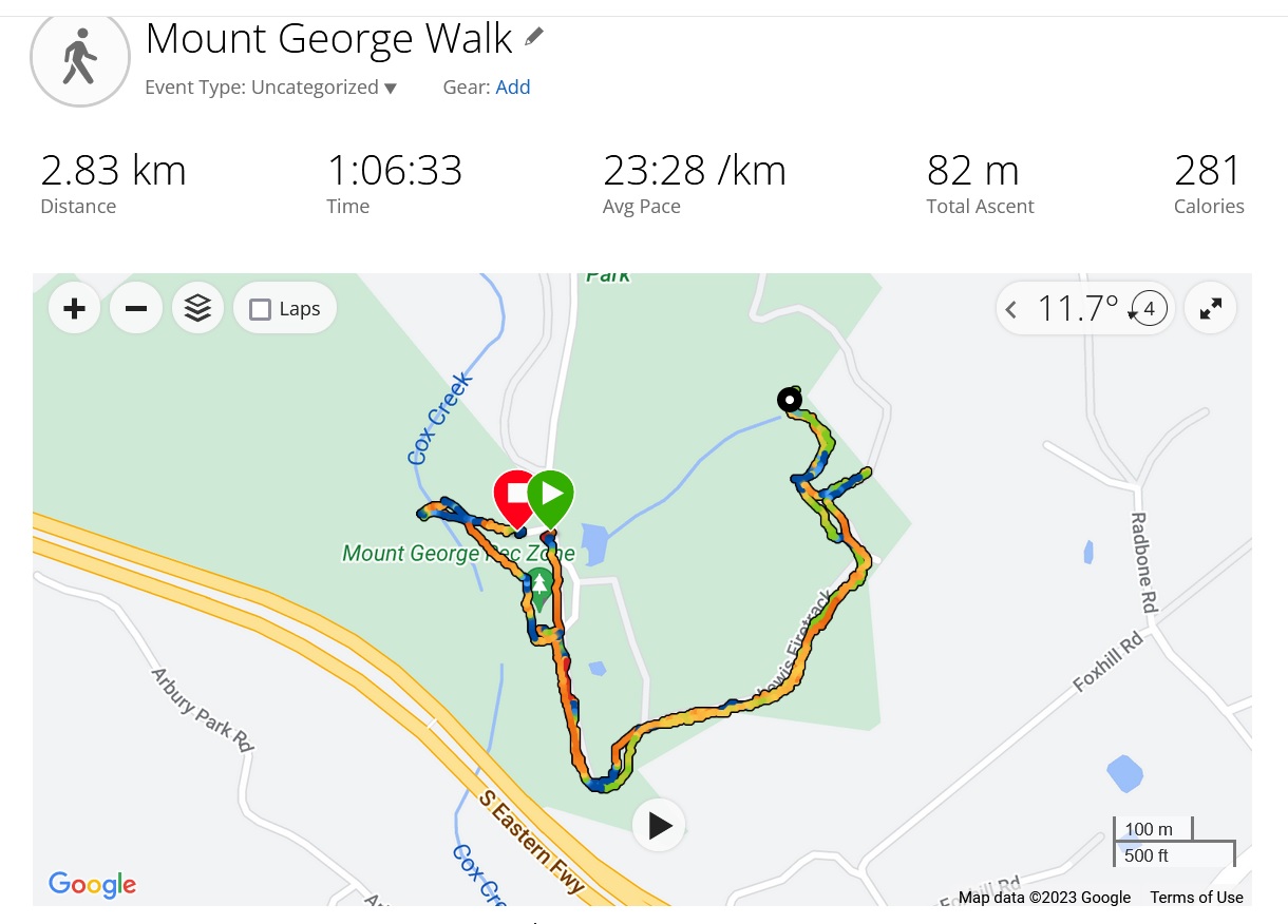
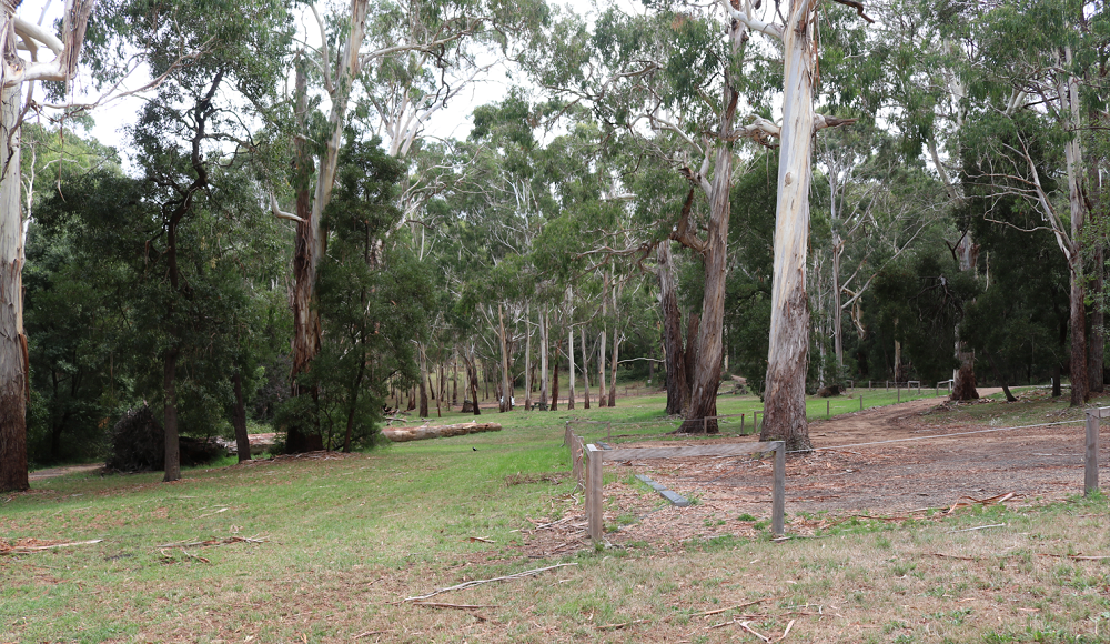
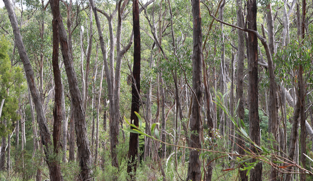
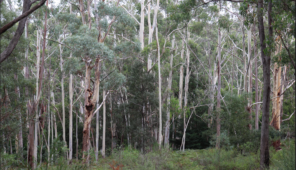
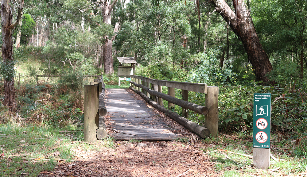
Today, 9th February 2023, I returned to the park for my daily walk and to take some photos. I decided to walk part of the Ridge Track, coloured blue on the map and on the right-hand side. I set off from the first car park in the picnic ground and arrived at a closed, locked and quite high gate. On closer inspection there is a small pedestrian gate within the larger structure. These could be the gates of hell or heaven, depending on your level of fitness. Walking SA suggests the loop takes about two hours, but I only walk for one hour, so I thought I would tackle the track and walk for 30 minutes and then return.
The photo above shows my walk. I got as far as the creek crossing. So close! Next time I will get to the lookout and the Mount George summit and walk the loop.
I was pleased to participate in the in the 2021 VKFF Activation Weekend. I notified Paul, VK5PAS, over two weeks ago and expressed the usual caveat relating to the weather. I would not visit the parks if the weather was inclement. We have had a wet and cold Spring. And two weeks out was too early for the Weather Bureau to provide a provisional forecast. On the Saturday the weather was great. I indicated that I would activate The Knoll Conservation Park, VKFF-0937. The last time I activated this park was on the 1st March 2013, eight years ago. In those days there were fewer amateurs interested in low power portable operations and I made seven contacts. Here is a link to that activation: https://vk5bje.com/2013/08/21/closer-to-home-some-adelaide-parks/
The Park
I have driven past The Knoll Conservation Park many times. I remembered where I set up my station and the main features of the park. But what I had forgotten was the ‘QRM’, audio, noise from cars speeding past the park. There was no or very little electrical noise – just the noise of cars, trucks and motorbikes passing by. It is an old park, established in 1967 and about 520 metres above sea level. the highest point is home to commercial/ public service radio installations. It is just two hectares in size and I have had the place to myself on the two radio visits I have made.
A search of the internet turns up many entries including one by VK5PAS. Birds SA has a site indicating the various bird species found in the park.
The Knoll Conservation Park – not far from Mount Lofty
Map Courtesy of Mapcarta
Contacts
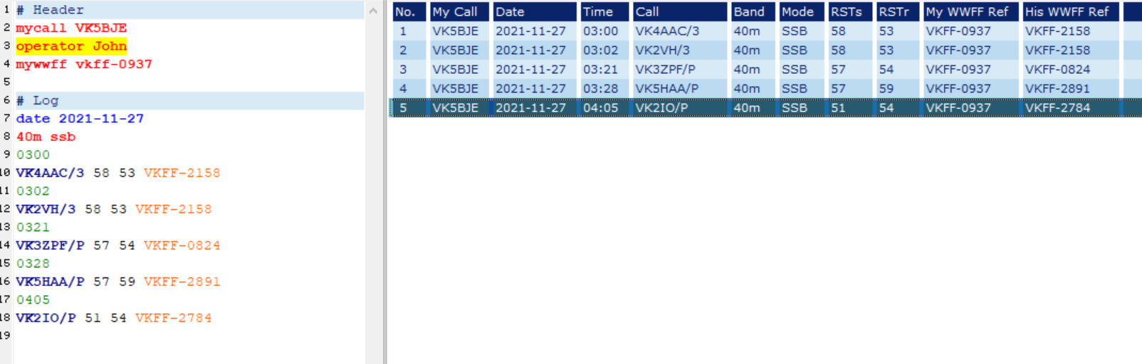
My Log for The Knoll (click to expand)
I use a paper log book and transcribe my contacts into FLE (Fast Log Entry) by DF3CB. I used the WWFF formatting settings as all my contacts (five) were with stations in other parks, If you work a SOTA (Summits on the air) station as well as Parks stations change the settings accordingly. All my contacts were on the 40m band: none on 80m or 20m. I spent some time trying to find the fault in the antenna and will say more about that matter when I write a post on Mylor Conservation Park which I activated on Sunday 28th November. I have qualified this park for VKFF. I am very unlikely to return to The Knoll Conservation Park. I am just a few days off an unwanted award, well I really don’t mind getting it and ‘time marches on’. The award is the OBE: over b…..80! So I was pleased with my efforts. Thanks to all who gave me a call and I was delighted to have contacts with them all!
For the activation my station consisted of a Yaesu 857D transceiver set for ten watts and a five band linked dipole. I later substituted a home brewed dipole for 40m and 20m.
Finally, I had a visitor. John, VK5HAA who was activating VKFF-2891, he told me he was packing up and would call in at The KnollConservation Park to catch up. He said it would probably be an hour before he arrived. I was pulling down my station when he walked up the fire trail. We had a great eye ball contact and he brought me up to date with the changes he has made to his station. It was really good to see him.