Since my last activation, we have moved house from the Adelaide Hills (Scott Creek) to Marion. We are ‘suburbanites’ and have begun to develop a life style around our new surroundings. My daily walks are now on flat land and I am attending a strength and balance class at a local gym. There have also been quite a few medical appointments.
I am yet to re-establish my station although I have an HF antenna installed and have operated from our back-yard. The delay in setting up in a ‘final’ location (shack) was making a decision about how each room will be used in our house.
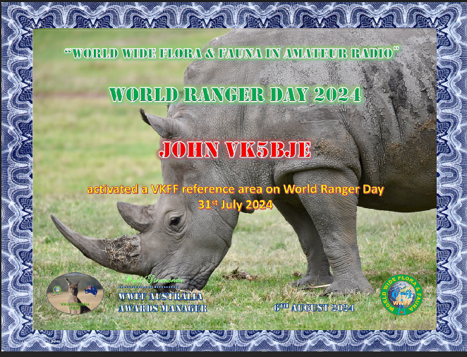
World Ranger Day
World Ranger Day alerts governments, organisations and individuals to the work of Park Rangers and the need to commit to preserving the broader environment as well as parks for the generations to come.
Belair National Park, VKFF-0022
I chose to activate Belair National Park, VKFF -0022. Belair National Park is the second oldest national park in Australia. The oldest is Royal National Park in NSW, which was created in 1879, and located just south of Sydney. Belair National Park was proclaimed in 1891, second in Australia and tenth in the world.
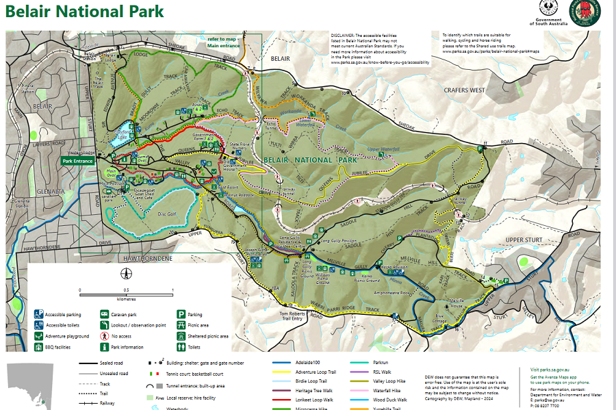
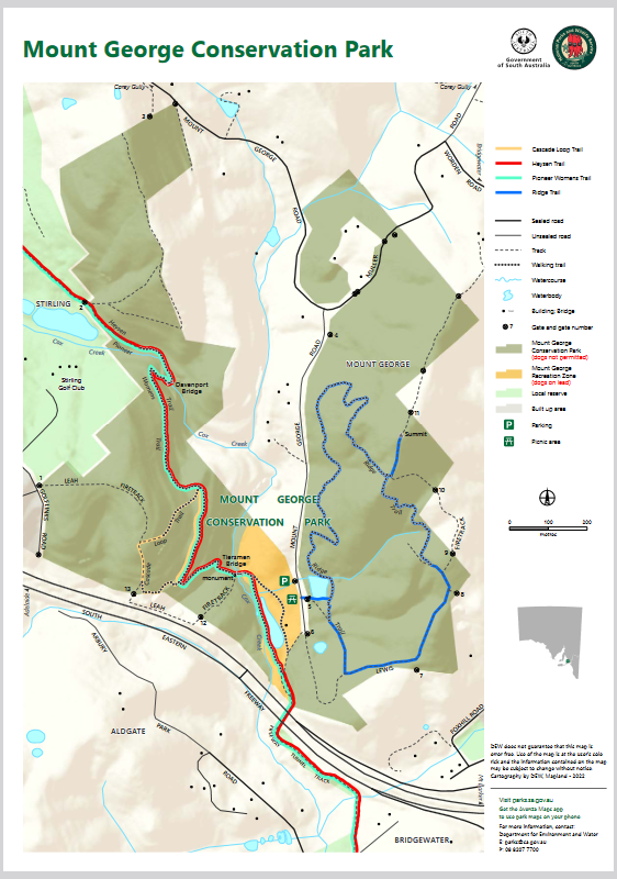
Map – courtesy of SA National Park Service from Belair page.
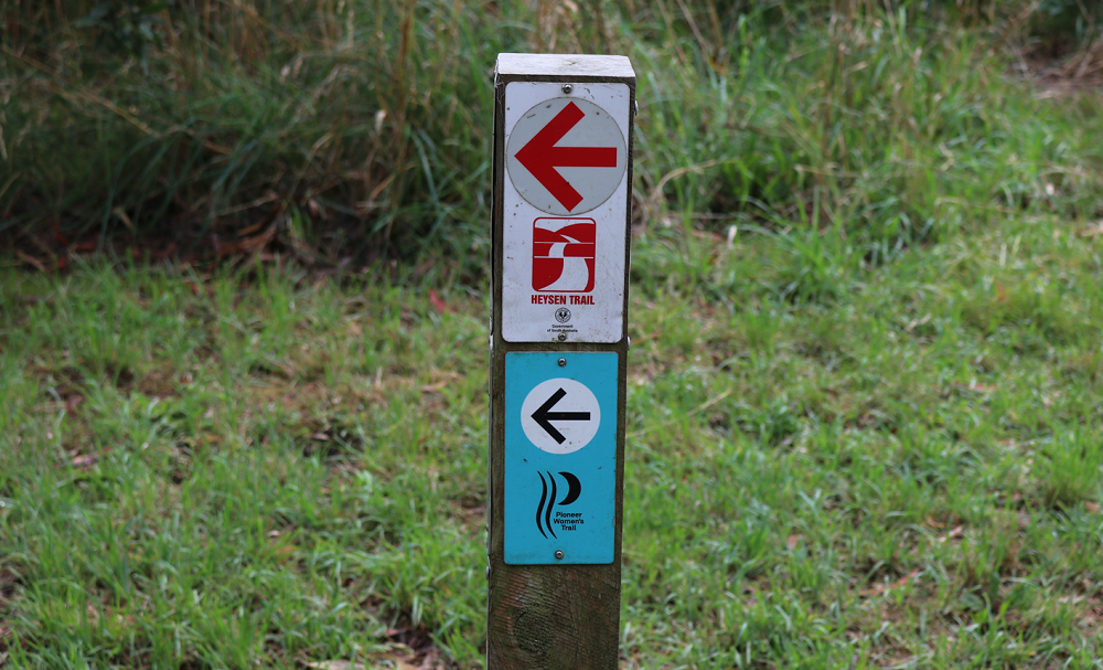
My location was Long Gully picnic area. It was quiet – just a few walkers, joggers and bike riders traveling past. Long Gully picnic area is visible on the map just below the railway line where is travels through a tunnel marked with white background on map.
I have ‘played radio’ many times in this park. Here is a link to my most recent activation. Click on Belair National Park in the index. I have also participated in World Ranger Day at Mylor Conservation Park on the 31 July 2019. Click Mylor Conservation Park in the index. for this activation I used my Icom 705 portable radio, 10 watts output and my home brew 20/40 metre linked dipole. I did mess about with a vertical unsuccessfully and this delayed the start of my operation.
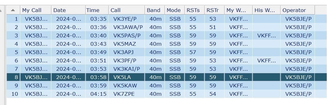
Here is my log of contacts: all VKs.
Thanks to all who gave me a call and especially Marija, VK5MAZ, who posted my presence in the park a number of times.
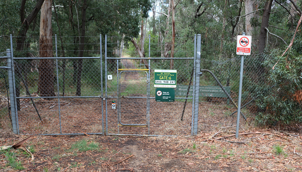
The weekend beginning 13th May produced some really splendid Autumn days in Adelaide. I decided on Sunday that I would return to Mount George Conservation Park and try to complete my activation with 44 contacts thus qualifying the park for WWFF.
I had a most enjoyable activation with some action on 20 metres although no DX. I would need to stay on later in the afternoon to work Europeans and maybe US stations. My time endurance is limited by a medical condition! I am not growling, but just have to work within my limitations.
The weather has now changed back to cold and wet late Autumn and activation days will become less frequent.
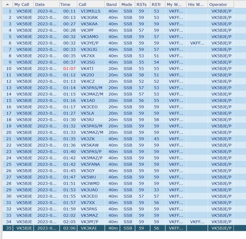
I have reproduced my log below (Fast Log Entry) and appreciate all of the calls, including two park to park contacts with VK3YE/P and VK3PF/P. I appreciate the contacts from all who chased me and those who worked me on two bands, and especially VK5PAS and VK5MAZ who contacted me while mobile, from a mill at Strathalbyn and from their home as well as on 40m and 20m.
Click on log to expand
The park adjoins the South Eastern Freeway and every time I visit the vehicle noise from the freeway is almost overwhelming. It is loud! But it soon disappears and fades into the background. No, this is not some new doppler-like effect! I am sure it is a result of my intense concentration on matters radio. I will return to the park as I want to activate the Mount Lofty parks near my home with cw mode contacts. I need the discipline of leaving the microphone at home!
A second visit to this beautiful park was undertaken to try and bring my contact score towards 44 – the magic number to qualify the park. I did not reach 44 but gained an additional 15 qsos.
Mount George Conservation Park has been on my to-visit list for a long time. It is nearly a decade since I last activated this park on the 4th August 2013. It was a mid-winter’s day but I succeeded in gaining 18 contacts before retreating to Barry’s house (VK5BW) to attend to my hypothermia with a cup of coffee. I did not give my post for 4th August 2013 a name, but it is accessible within this blog by clicking on the relevant date in the index of dates. And I did not upload my log to WWFF. I suspect that the activation was for the South Australian award (SANCPA), before WWFF began in Australia.
Contacts
7.160
05:48 Peter, VK3PF
06:06 VK3AMO Rob
06:02 VK5NPP, Phil
06{08 VK3ZPF Peter
06:08 VK5KAA, Gordon
06:10 VK3BBB, Brian
06:13 VK2CCP, Brian
06:13 VK5LA, Andy
06:13 VK3UAO, Stuart
06:14 VK5TN, Robin
06:16 VK3GJG, Garrick
06:17 VK5AYL, Sue
06:17 VK3ANL, Nick
06:18 VK5CZ , Ian
06:20 VK5IS, Ian
06:24 VK5UV, Rod
Sixteen contacts were enjoyed. Ah, the magic of radio!
The Tracks
‘There are other approaches to thinking about the ‘ways of the elders’ and my mind immediately focused on the first nations people of this continent and their ways, their tracks, their knowledge of how to get from a to b. I have been unable to find and references to the tracks in the Mylor Conservation Park and how they were formed, but I suspect they are more recent, that is, made by the first Europeans who settled here in 1836. But were their foundations laid down by earlier peoples? It is very likely and Grace Karskens, an historian, citing Sim (1966), a public servant, who stated ‘White men often built their roads along Aboriginal tracks, especially those following ridges1. She is writing about the peoples of the Hawkesbury River and gives many examples, familiar of course, to people living in that part on NSW.
In Adelaide the Pioneer Women’s Trail is 23.7 kilometres long and is rated as a hard walk. It dates from about 1840, and was used for about 30 years as a commercial route, walked by women and girls to take produce grown in the hills to the city for sale. Those heavily laden walkers began their walk about midnight 2.
The area traversed by the trail is divided by the ‘boundary’ between two Aboriginal groups:the Kaurna people who lived on the Adelaide plains and the Western side of the Mount Lofty Ranges and the Peramangk people whose lands extended from the Eastern side of the Mount Lofty Ranges to the Murray River. Some sources suggest the trails through Cleland National Park (Kaurna) and Mount George Conservation Park (Peramangk) are Aboriginal tracks 3′.
Karskens, G., 2020, People of the River: Lost Worlds of early Australia. Sydney. Allen & Unwin.
Steiner, M., 2000, Scott Creek: From Settlement to Conservation. Friends of Scott Creek Conservation Park. p. 7. See also Jones, Bevan, Participation Grows for Pioneer Women’s Walk. The Courier, Wednesday May 25th 2022.
Coles, R. & Hunter, R., 2010, The Ochre Warriers: Peramangk culture and rock art in the Adelaide Ranges. Stepney. Axiom Australia. See p. 13 for the map of the Mount Lofty Ranges showing the boundary of the Peramangk country and other local first nations.
Excerpt from Walking, 2022, John Dawes
The Park
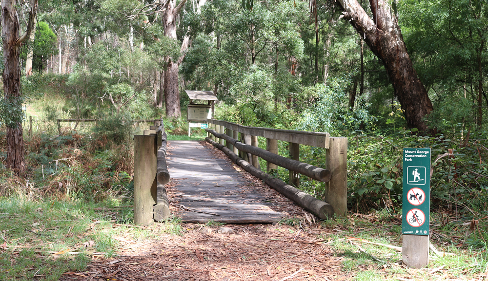
Mount George Conservation Park is one of the Mount Lofty Parks in the Adelaide Hills and is near Bridgewater and adjoins the South Eastern Freeway The map below, courtesy of the Department of Environment and Water, shows the park as two fingers of protected land with private property in between. The South Eastern Freeway is visible at the bottom of the map as are two parking signs. The background is a lighter colour and it is the picnic ground. It is part of the park and dogs are allowed here on leads. I activated within this area and there were very few people in the park. I spoke to one person who wanted to know what I was doing
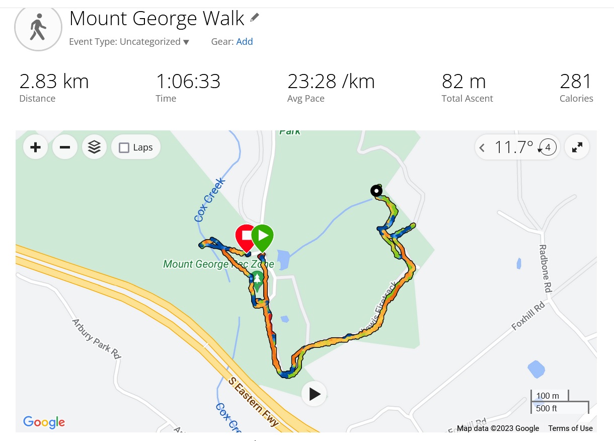
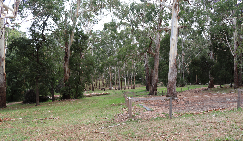
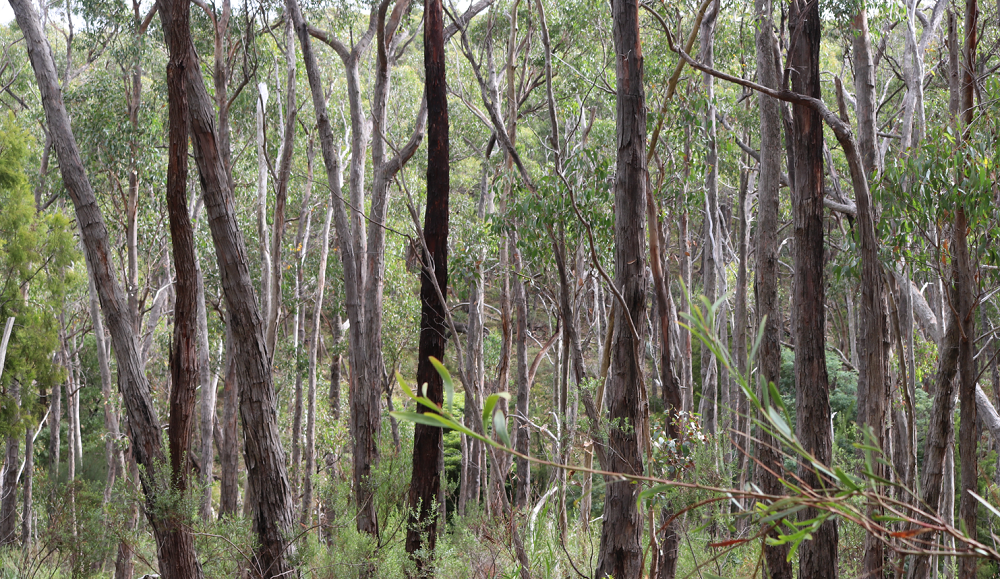
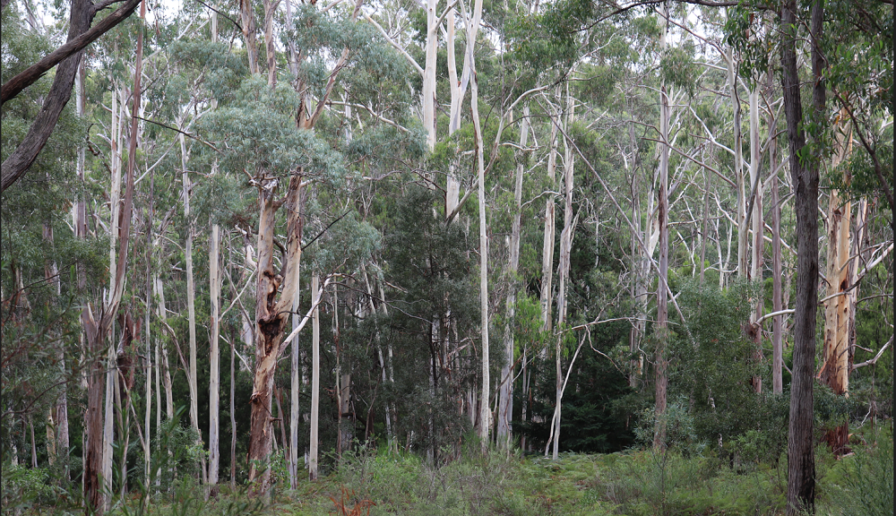
Today, 9th February 2023, I returned to the park for my daily walk and to take some photos. I decided to walk part of the Ridge Track, coloured blue on the map and on the right-hand side. I set off from the first car park in the picnic ground and arrived at a closed, locked and quite high gate. On closer inspection there is a small pedestrian gate within the larger structure. These could be the gates of hell or heaven, depending on your level of fitness. Walking SA suggests the loop takes about two hours, but I only walk for one hour, so I thought I would tackle the track and walk for 30 minutes and then return.
The photo above shows my walk. I got as far as the creek crossing. So close! Next time I will get to the lookout and the Mount George summit and walk the loop.
Belair NP is perhaps not a typical National Park. While it preserves Old Government House, the State Flora Nursery and some native bushland it also has many recreation facilities and, rather uniquely, it allows walking of dogs on leads. It is also intersected by the Adelaide to Melbourne Railway. It was previously known as the Belair Recreation Park and was the first park gazetted in South Australia. I activated this park on the afternoon of the 1st August. I had five contacts: VK5LY/p, Larry; VK5HCF, Col; VK3KAN/p, Rick in the Bogong National Park using a KX3; VK5EE, Tom; and VK5PAS, Paul.
The Knoll Conservation Park 1 August 2013
After leaving Belair NP it is just a short drive to The Knoll CP. The Knoll is a small park and one brochure indicated that it was closed to the public because of the communications tower located within its boundaries. I knew that VK5PAS, Paul had earlier activated this Park and that one of the National Park rangers knew of my activities there (after the event). There are no signs indicating it is closed to the public. I had seven contacts: VK5LY, Larry; VK5PAS, Paul; VK3FD/p4, QRP (2.5 watts), Ian; VK5AKK /QRP, 5 watts, Phil; VK5FMID, Brian; VK5EE, Tom and VK5HCF/QRP (5 watts) Col.
Thanks to all of those amateurs with whom I had contacts, especially the family of Park ‘chasers’.
Mt George Conservation Park 4 August 2013
On a threatening Sunday afternoon I decided to activate Mt George CP, like Belair NP and The Knoll CP, not far from my home. After 18 contacts, VK5BW, Barry, decided I needed to treat my hypothermia and he invited me around to his home, just a few kilometres away for a hot drink: a splendid way to finish a great day. There were quite a few walkers in the Park and I had a number of curious folk ask me questions about what I was doing. One young woman told me her Grandfather was an amateur. It was too windy for me to put out my information sign. Many thanks to the following amateurs, including some new call signs for me: VK5PAS/p, Paul in Horsnell Gully CP, who was also cold and wet; VK3UBY, Colin from Mildura; VK5WG, Nev; VK5LY, Larry; VK5FMID, Brian; VK5EE, Tom; VK5FTTC, Rod; VK5ZAI, Tony; VK5ZTJ/m, Trevor; VK5HCF, Colin; VK5NRG, Roy; VK5LI, Craig; VK5IS, Ian; VK5PAS/p, Giles CP (now even colder and wetter); VK5TN, Robin; VK5LA, Andy; VK5FTCT, John and that kind soul, VK5BW, Barry.
By now you should be able to guess: no pictures – no Jenny, my wife, accompanying me! She is the photographer.