The RAOTC Journal for March 23 has two articles by VK5s. The first is How I got to be a Ham by John Drew, VK5DJ, RAOTC member no 951. This is a splendid article and gave me an insight into radio practice and experiences in the 1960s and earlier. John writies about getting on 288 Mhz (one metre band), super regenerative receivers and AM. John has previously been published in that Journal in 2010.
The second article is called Experimenting with 160 metres, by me, John Dawes, RAOTC member no 1764. This is my first time in print with this Journal. Sure I have a conflict of interest, but it gives me a chance to bring to your attention this wonderful Journal.
The Journal is 60 pages and is published each March and September. I commend the RAOTC to you.
Mount George Conservation Park has been on my to-visit list for a long time. It is nearly a decade since I last activated this park on the 4th August 2013. It was a mid-winter’s day but I succeeded in gaining 18 contacts before retreating to Barry’s house (VK5BW) to attend to my hypothermia with a cup of coffee. I did not give my post for 4th August 2013 a name, but it is accessible within this blog by clicking on the relevant date in the index of dates. And I did not upload my log to WWFF. I suspect that the activation was for the South Australian award (SANCPA), before WWFF began in Australia.
Contacts
7.160
05:48 Peter, VK3PF
06:06 VK3AMO Rob
06:02 VK5NPP, Phil
06{08 VK3ZPF Peter
06:08 VK5KAA, Gordon
06:10 VK3BBB, Brian
06:13 VK2CCP, Brian
06:13 VK5LA, Andy
06:13 VK3UAO, Stuart
06:14 VK5TN, Robin
06:16 VK3GJG, Garrick
06:17 VK5AYL, Sue
06:17 VK3ANL, Nick
06:18 VK5CZ , Ian
06:20 VK5IS, Ian
06:24 VK5UV, Rod
Sixteen contacts were enjoyed. Ah, the magic of radio!
The Tracks
‘There are other approaches to thinking about the ‘ways of the elders’ and my mind immediately focused on the first nations people of this continent and their ways, their tracks, their knowledge of how to get from a to b. I have been unable to find and references to the tracks in the Mylor Conservation Park and how they were formed, but I suspect they are more recent, that is, made by the first Europeans who settled here in 1836. But were their foundations laid down by earlier peoples? It is very likely and Grace Karskens, an historian, citing Sim (1966), a public servant, who stated ‘White men often built their roads along Aboriginal tracks, especially those following ridges1. She is writing about the peoples of the Hawkesbury River and gives many examples, familiar of course, to people living in that part on NSW.
In Adelaide the Pioneer Women’s Trail is 23.7 kilometres long and is rated as a hard walk. It dates from about 1840, and was used for about 30 years as a commercial route, walked by women and girls to take produce grown in the hills to the city for sale. Those heavily laden walkers began their walk about midnight 2.
The area traversed by the trail is divided by the ‘boundary’ between two Aboriginal groups:the Kaurna people who lived on the Adelaide plains and the Western side of the Mount Lofty Ranges and the Peramangk people whose lands extended from the Eastern side of the Mount Lofty Ranges to the Murray River. Some sources suggest the trails through Cleland National Park (Kaurna) and Mount George Conservation Park (Peramangk) are Aboriginal tracks 3′.
Karskens, G., 2020, People of the River: Lost Worlds of early Australia. Sydney. Allen & Unwin.
Steiner, M., 2000, Scott Creek: From Settlement to Conservation. Friends of Scott Creek Conservation Park. p. 7. See also Jones, Bevan, Participation Grows for Pioneer Women’s Walk. The Courier, Wednesday May 25th 2022.
Coles, R. & Hunter, R., 2010, The Ochre Warriers: Peramangk culture and rock art in the Adelaide Ranges. Stepney. Axiom Australia. See p. 13 for the map of the Mount Lofty Ranges showing the boundary of the Peramangk country and other local first nations.
Excerpt from Walking, 2022, John Dawes
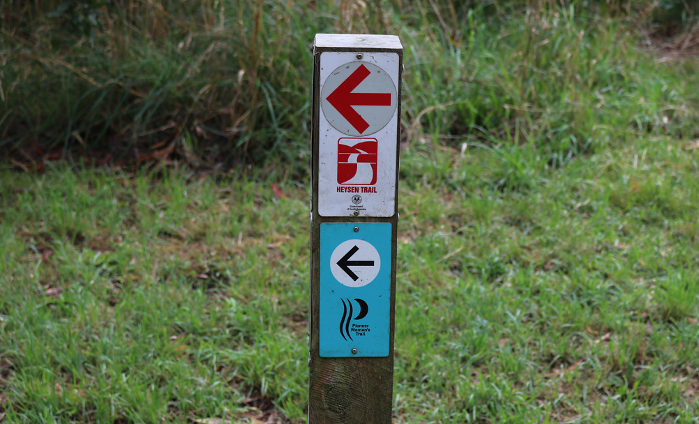
The Park
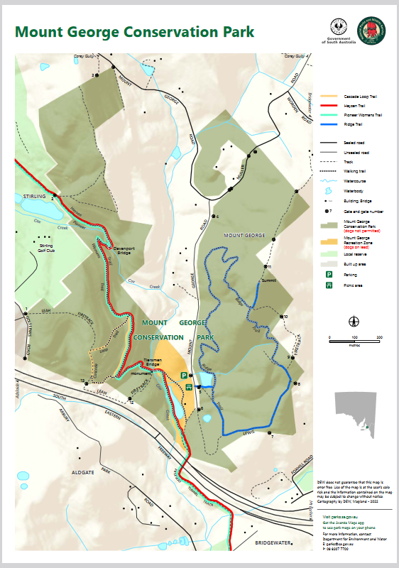
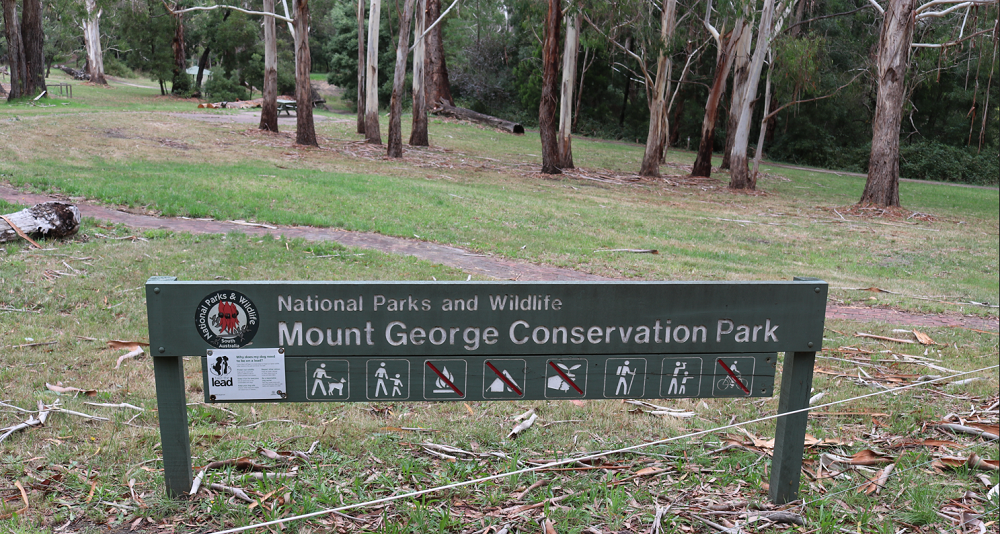
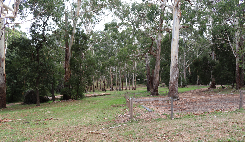
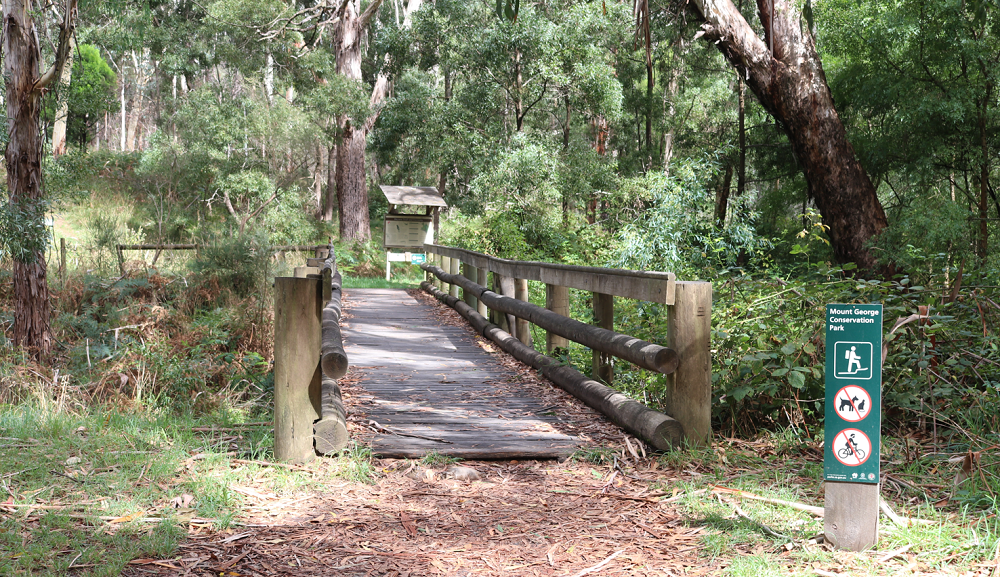
Mount George Conservation Park is one of the Mount Lofty Parks in the Adelaide Hills and is near Bridgewater and adjoins the South Eastern Freeway The map below, courtesy of the Department of Environment and Water, shows the park as two fingers of protected land with private property in between. The South Eastern Freeway is visible at the bottom of the map as are two parking signs. The background is a lighter colour and it is the picnic ground. It is part of the park and dogs are allowed here on leads. I activated within this area and there were very few people in the park. I spoke to one person who wanted to know what I was doing
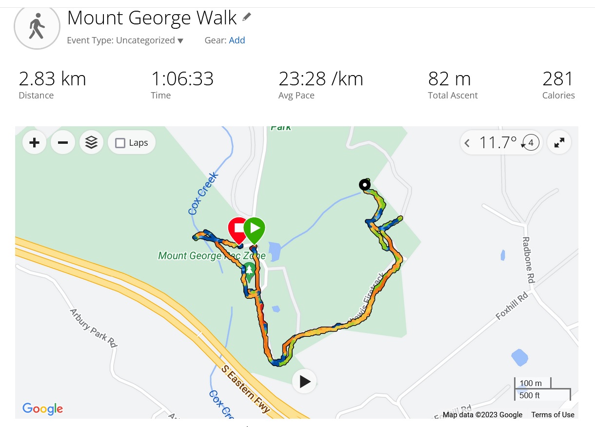
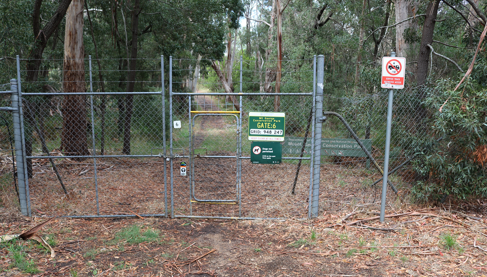
Today, 9th February 2023, I returned to the park for my daily walk and to take some photos. I decided to walk part of the Ridge Track, coloured blue on the map and on the right-hand side. I set off from the first car park in the picnic ground and arrived at a closed, locked and quite high gate. On closer inspection there is a small pedestrian gate within the larger structure. These could be the gates of hell or heaven, depending on your level of fitness. Walking SA suggests the loop takes about two hours, but I only walk for one hour, so I thought I would tackle the track and walk for 30 minutes and then return.
The photo above shows my walk. I got as far as the creek crossing. So close! Next time I will get to the lookout and the Mount George summit and walk the loop.
Late on Friday afternoon 3rd March 2023 I decided to visit Scott Creek Conservation Park to activate for the World Wide Flora and Fauna (WWFF) program in amateur radio, also commemorating World Wildlife Day.
I have activated this park many times and I chose a new location to set up my station. I usually choose Gate 8, a high point about 420 metres above sea level. However, this time I chose to set up at Almanda Mine after checking out two other locations: Gate 14 and the car park near Mackereth Cottage. Gate 14 would be a reasonable spot but the open area near Almanda mine was very good. But I soon found a major issue: there is no mobile phone coverage and I could not spot my station. I decided I would persist and hope some kind fellow-amateur would put up a spot on parknpeaks.
I was going to start my search for contacts on 20 metres and did call on 14.044 CW using VK5PF and on 14.310 using sideband. I was not successful in raising any interest. So I added to the links in my dipole to make it resonant on 40 metres and called on 7.144 Mhz, after checking the frequency was not in use. I called CQ and was answered by Stuart, VK3UAO, who kindly spotted me. Have a look at Stuart’s very fine page at QRZ.com. Thanks very much Stuart for the spot.
Contacts
VK3UAO
VK3VIN
VK5HAA
VK5AYL
VK3PF p2p VKFF-2443
VK3BEZ p2p VKFF-2443
VK5TN
VK3ZPF p2p VKFF-2219
VK3BBB
VK2CCP
VK5BJF
VK5GY
VK5PET
I made 13 contacts in a little over half an hour and then packed up and returned home. I didn’t see any wildlife in the park, but at home, I was entertained for about half an hour, by six yellow-tailed black cockatoos who decided a hakea bush just outside the kitchen window needed a fresh prune! I like these highly sociable birds who stay close to to each other and talk away while they eat the nuts from the bush. At one stage there were five birds in the bush not much over a meter high, with junior sitting at the high point and having an occasional munch!
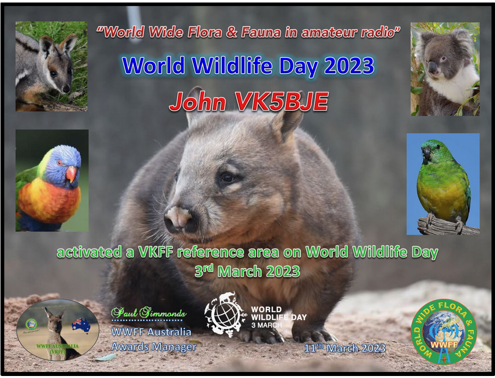
Thanks to all of the operators who gave me a call – always appreciated. And I enjoyed participating in World Wildlife Day for 2023.
The photo above is a certificate of participation in the World Wildlife Day 2023. All of the photos used in the certificate were taken by Paul, VK5PAS.