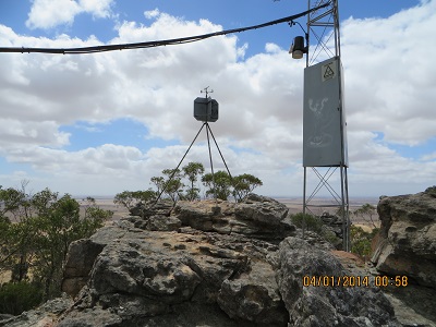
Sota peak Mount Arapilies, VK3 VN 022, 4th January 2014

Mt Arapilies - summit

Mt Arapilies – summit

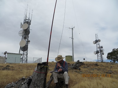
I decided to activate Mount Arapalies today, 4th January 2014.  The temperature was in the low twenties, there was no rain but the wind was blowing a gale. I drove up the single lane sealed track to the top: an easy drive and from the car park, walked to the summit where the trig point is located and also the site of the CFA fire-watch tower. The tower was occupied and I could hear radio chatter through the door of the building. I resisted the urge to knock and make myself known!  And I resisted the urge to call on the Mount Arapilies two metre repeater on 146.850 and try and stir up some business. As it turned out I made the right decision. There was no shortage of contacts. My first contact was at 01:02 and my last, 34 (33 successful) was at 02:42. The discrepancy was because of my obsessiveness over my signal report to a NSW mobile station. He just couldn’t understand his report.  He was 5 and 0 with me and the zero proved the problem.

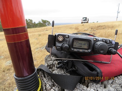
I decided not to set up on the summit as the wind was ferocious. I tucked myself away in a secluded spot and it wasn’t so bad. There are plenty of activation spots for the less adventurous, like me, if it is really windy. The place was busy: mainly walkers and rock climbers.

My first contact was with VK3CAT/p, Tony, in the Alpine National Park. Then followed VK5WG, Nev; VK5LY, Larry; VK3FB/p, Len; VK3FPSR, Peter; VK5CZ, Ian; VK5PAS, Paul; VK3YSP, Joe, at home; VK3FD, QRP 2.5 watts, Ian; VK3AMB, Bernard; VK5STU, Stu; VK5FUZZ, Paul; VK3IL/p, David; VK3ARR, Andrew; VK5FMID, Brian; VK5JDS/p, Darryl at Port Lincoln; VK3VBI, Ron; VK2DAG; VK3ANL, QRP, Delta Loop, Nick; VK5FRCP, Rex; VK3SOL, Fred; VK2YW/m, John; VK3YN, Mark; VK3BYD, Warren; VK3UT QRP, Greg; VK5HCF, Col; VK5IS, Ian; VK3MEG, Steve; VK1NAM, Andrew; VK3YDN, John, VK2PDW, Wayne; VK3VEK, Kevin and VK3JP, Ron.
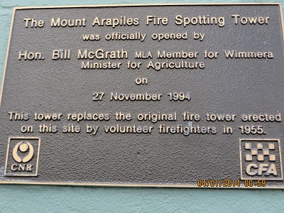
The dedication plaque for Fire Service lookout
The dedication plaque for Fire Service lookout
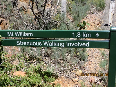
Sota Peak, Mt William, VK3 VS 001, Grampians National Park, 3rd January 2014, VKFF – 213

The start on the walking trail to the Mount William summit

The start on the walking trail to the Mount William summit

The climb to the  summit was quite strenuous and after checking out the Major Mitchell monument and the commercial radio installations I found a place  just four or five metres from the top where I could set up my station. Thanks to the 22 amateurs who made contact with me this morning on Mt William.

My first contact was with VK3HRA/P3, Allen who was on SOTA summit VK3/VS-001; VK3FPSR, Peter;  VK5WG, Nev;  VK3AMB, Bernard; VK3DET, Ernie; VK5STU/P5, Stu on Mount Gawler, VK5/SE-013; Vk5PAS, Paul;  VK5LY, Larry; VK2DAG, Matt; VK5WG, Nev; VK5NIG/P5, Nigel on SOTA summit VK5/SE-013; VK5CZ, Ian; VK3ANP, David; VK3FPSR, Peter; VK3IL/P3, David; VK3HRA, Allen; VK3AMB, Bernard; VK5MBD, Bill; VK1NAM, Andrew; VK3BHR, Phil; VK3BQ/P2, Andrew in Mount Kosciusko National Park and VK3XPT/P7, Perren at Devonport.

Kara Kara National Park, 2nd January 2014, VKFF – 629

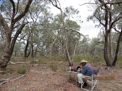
In Kara Kara National Park

In Kara Kara National Park

Kara Kara National Park was accessed via the Sunraysia Highway, Boundary Road and then a track, probably originally a fire break along the side of the Park. We drove into the Park about 500 metres. A convenient tree provide a point for mounting the centre of the dipole and it wasn’t long before I was in business!

Eleven contacts were had from Kara Kara NP beginning at UTC 04:17: VK5LY, Larry; VK5GJ, Greg; VK3MCD/p, Brian in Mount Kosciuszko National Park on Granite Mountain, VK2 SW 015; VK5AS, Paul; VK3DET, Ernie; VK5JW, Jim; VK3AFW, Ron; VK5FDEC, Damien; VK3XPT/p, Perren portable in Devonport with his FT817; VK3MEG, Steve; VK5MBD, Bill from Red Hill.

SOTA Mt Moliagul, VK3/VN-024

VK2YW, John's S9 signal

VK2YW, John’s S9 signal

Dead stumps come in handy: near the summit of Mount Moliagul

Dead stumps come in handy: near the summit of Mount Moliagul

I have driven past Mt Moliagul many times as we travel to and from Bendigo. I have also used the 70cm repeater located there. A good signal can be received around most places in Bendigo. But today was my first visit to the summit. The gravel road, while a bit rough in places and with a steep bend near the top, could easily accommodate two-wheel drive vehicles. I parked the car a little away from the summit and walked down to the artificial tree line below the activation zone (the summit has been cleared) to inspect a tree before collecting my gear and making use of a handy stump.

Eleven contacts were made on 7090 beginning at 02:01, VK5HCF, Col; VK3VT, Greg (I used to belong to the same radio club as Greg in the late 1970’s at Greensborough and it was great to catch up with him on the air); VK5WG, Nev; VK5AK, Bob; VK2YW, John at Wagga Wagga; VK5NIG, Nigel; VK5PAS, Paul; VK5LY, Larry; VK5EE, Tom; VK2UH, Andrew and VK1VAM/p.

Greater Bendigo National Park, 2nd January 2014

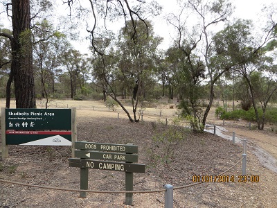
Shadbolts Picnic Area Greater Bendigo NP

Shadbolts Picnic Area Greater Bendigo NP

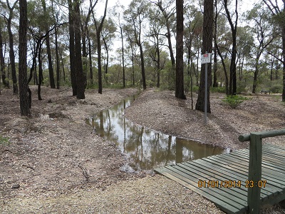
Water Channel in GB NP

Water Channel in GB NP

Greater Bendigo National Park is comprised of a number of sections: two large ones, north and south of the city, with the southern portion divided into two smaller sections. I chose to activate a section of the park just north of Eaglehawk. Shadbolt Picnic Ground is an interesting place with a water channel winding its way through the park with plenty of spots for a picnic. I chose one of the park picnic tables to affix my squid pole and soon got down to business with my first contact at 22:34, VK3MRG, Marshall; VK3YSP, Joe on Mount Donna Buang, VK3 VC 002 in the Yarra Ranges National Park and VK3FOWL, Julie from the same spot. Then followed VK5LY, Larry; VK5KGP, Graham; VK5EE, Tom; VK3NCC/m, Colin; VK5BZ, Bob; VK5KC, David; VK3FQ, Ray; VK5LDM, Dennis; VK5NRG, Roy; and VK3ANP, David, a total of 13 contacts.

Heathcote-Graytown National Park, 1st January 2014, VKFF – 624

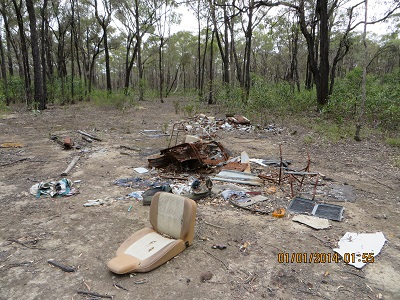
Private Rubbish Dump in Heathcote-Graytown NP

Private Rubbish Dump in Heathcote-Graytown NP

I activated Heathcote-Graytown National Park on route from Wangaratta to Bendigo. We found a small track leading off the main road from Nagambie  to Heathcote, where the Park borders the road and decided to explore that. The GPS reading is S36 48 700 and E145 00 090. It was here that I found the rubbish dumped in a small clearing. If we had travelled on a further two kilometres we would have found a picnic ground. Six contacts were made beginning at 02:34: VK3YSP/p at Mount Sugarloaf in the Kinglake National Park, then VK3FOWL, Julie; VK2TWR/p3, Rod on SOTA summit VK3 SW 007; VK3ARM, Robert; VK2AFA, Sam on SOTA summit VK2 NT 004 and VK5TW, Trevor.

Lower Goulburn National Park, 1st January 2014

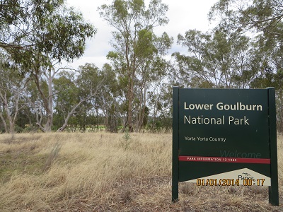
Lower Goulburn National Park - Reedy Swamp

Lower Goulburn National Park – Reedy Swamp

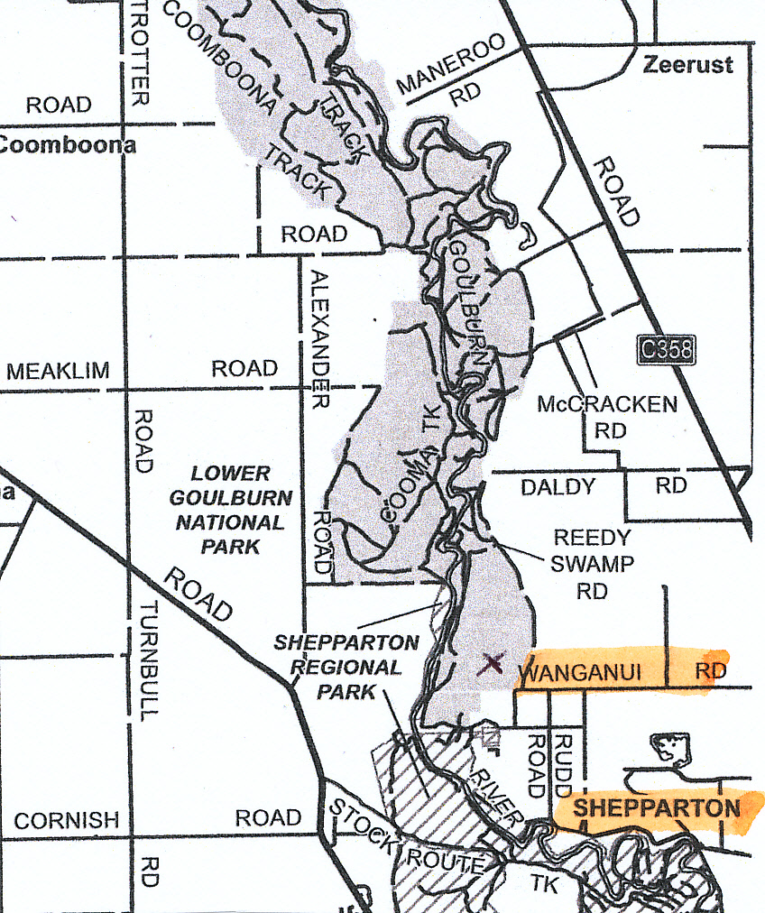
To find an appropriate activation spot in the Park I relied upon the excellent Parks Victoria Visitor Guide for this park. We chose the southern end of the park right near Shepparton. We travelled Wanganui Road until we saw the park sign and then turned right along Reedy Swamp Road. This is the southern most end of the park which then follows the Goulburn River to where it joins the Murray. The Park is on both sides of the River. While the section I used is degraded, at least the land is reserved, protected and will be available for people into the future. This park makes it abundantly clear that the land belongs to the people of Victoria and the nation. My first contact at 23:13 was with VK1NAM/p, Andrew portable on SOTA summit VK1 AC 038; VK3YSP, Joe; VK3FOWL, Julie; VK3MRG/p, Marshall on SOTA summit VK3 VE 001; VK5LY, Larry; VK1MA, Matt; VK5EE, Tom; VK3MTB, Tim; VK5IS, Ian; VK3HRA/p, Allen, on SOTA summit VK3 VS 002; VK1RX/p, Al, on SOTA summit VK2 ST 034; VK3ARR/p, Andrew, on SOTA summit VK3 VC 030; VK3AFW, Ron, on SOTA summit VK3 VC 008; VK5KSW, Steve and VK5DJ, John. Fifteen contacts logged and then the band went quiet. It was time to find Heathcote-Graytown National Park.

Lower Goulburn National Park: near Shepparton

Lower Goulburn National Park: near Shepparton

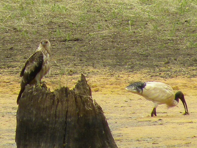
Juvenile Whistling Kite and White Ibis JCD picture

Juvenile Whistling Kite and White Ibis JCD picture

Alpine National Park, 31st December 2013, VKFF – 619

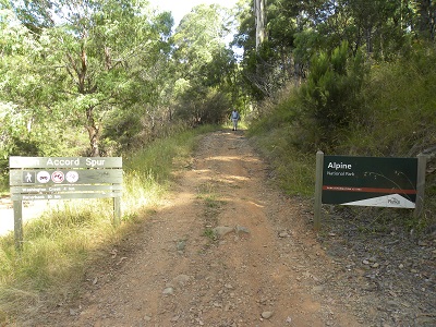
Alpine National Park Accord Spur

Alpine National Park Accord Spur

After enjoying Mt Buffalo National Park I decided I would tackle something a little easier in the late afternoon. Thirteen contacts were all great and signals were so different to those I heard in the morning. They were loud!

My first contact was at 06:34 on 7090 with VK3VEK, Kevin; VK3ANP, David; VK3FBP, Len; VK5PAS, Paul; VK3SE, Steve; VK3SOG, Fred; VK5CZ, Ian; VK3ANP, David; VK5EE, Tom; VK5FBAC, Charles; VK2UH (VK1DA) a real rag chew, great contact; VK5KC, David and VK5FMID, Brian, making 13 contacts in all.

Alpine National Park

Alpine National Park

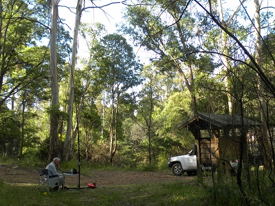
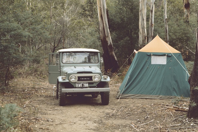
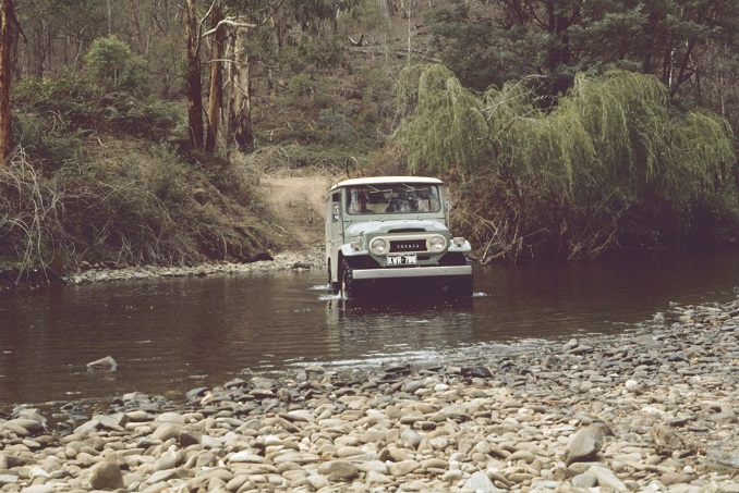
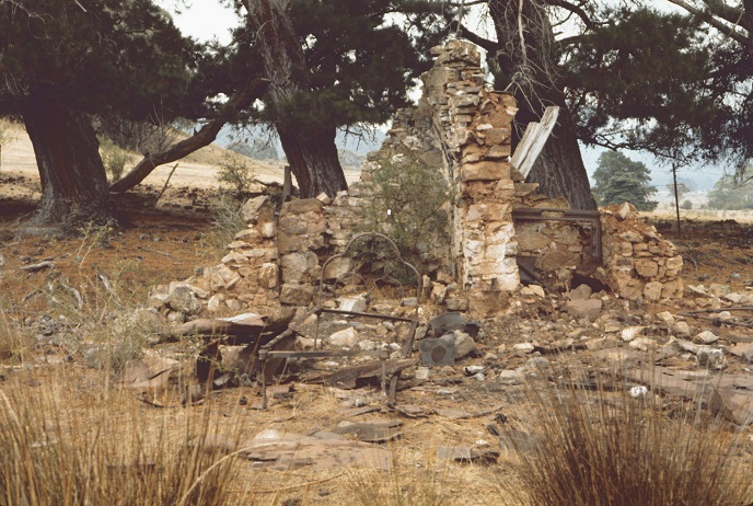
‘The Alpine National Park stretches from central Gippsland all the way to the New South Wales border where it adjoins Kosciusko National Park. Within the park are some of Australia’s most stunning alpine landscapes, including mountain peaks, escarpments and grassy high plains’ (Parks Victoria brochure). Bon Accord Spur was accessed from a track near the East Branch of the Ovens River. So our visit was at the Northern end of the park. We have previously visited the Alpine National Park on two occasions approaching from Gippsland and making our way to the Wonnangatta Station. It was not a National Park then: but Crown Land and Forrest Commission Land. In 1973 and 1977 when we visited, it was known to a much smaller group of 4 x 4 enthusiasts than it is now. The trip into Wonnangatta from Gippsland was regarded then as challenging, with quite a few river crossings and steep climbing on narrow tracks. It may be more challenging now dealing with the extra traffic and the chopped up tracks and damaged river crossings. Our approach to driving here was cautious: as it was our first real excursion to an out of the way location. We were self-taught 4 x 4 drivers. We did not join a club until late 1998 in South Australia. We walked every river crossing before venturing in! The picture shows that I walked this crossing (a baby one) but I will admit JCD walked more! Here are a few more pictures from the VK5BJE archives.

A great camping spot on the way to Wonnangatta Station March 1973

A great camping spot on the way to Wonnangatta Station March 1973

JCD driving our short wheel-base Toyota Land Cruiser across one of many river crossings, March 1973

JCD driving our short wheel-base Toyota Land Cruiser across one of many river crossings, March 1973

House ruins at Wonnangatta - accidently destroyed by fire in 1957

House ruins at Wonnangatta – accidently destroyed by fire in 1957

Sota Summit ‘The Horn’ in Mt Buffalo National Park, 31st December 2013, VKFF – 339

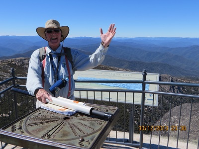
Sota Summit VK3 VE 014 is a special point on the Mt Buffalo plateau: called ‘the Great Granite Plateau’ in the ‘Park Notes’ published by the Victorian Government. Its elevation is 1723 metres and is at the end of a 1.5k track, which the sign board says takes 45 minutes, is a lookout giving spectacular views for 360 degrees. After arriving there I did not think I could safely activate from that point and proceed to look for a suitable location within the activation zone. I eventually set up my gear and called CQ on 7095. I did not get a response and tuned around to find a pretty quiet band. I did hear VK3YSP/p, Joe and VK3FOWL/p, Julie calling from the Lower Goulburn River National Park. They were attracting considerable interest. I joined the queue and after a successful contact with both of them asked Joe to let people know that I would be operating on 7095. I migrated there and enjoyed contacts with VK3BHE, Phil; VK3FMPB/p, John in the Kinglake National Park, VK3MJB, Tim in the La Trobe Valley and VK3AMB, Bernard. Received signal reports ranged from 5 and 0 to 4 and 3. Six contacts means I have successfully activated this SOTA summit. But it was a difficult activation. While I enjoyed the reasonably difficult climb, the views and speaking to quite a number of people, I thought I might be louder! It was not to be.

Back on top! 'The Horn'

Back on top! ‘The Horn’

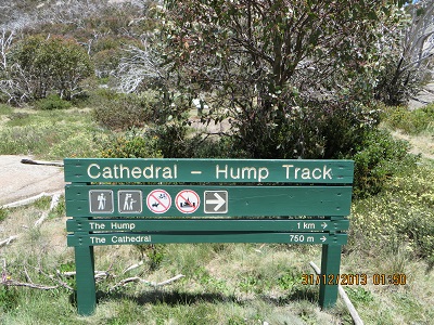
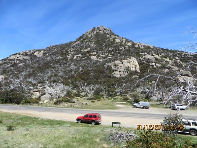
I did propose to activate ‘The Hump’. I found the walk challenging as have some previous SOTA activators. I got quite a way up the track but decided to quit: it was warm and I was tired. My wife Jenny got to the top and she said the last bit was quite tough. I was sorry that I was not able to activate this peak – maybe next time! Perhaps I was being too ambitious?

Cathedral - Hump Track

Cathedral – Hump Track

The Hump - Just a mere pile of rocks!

The Hump – Just a mere pile of rocks!

Warby-Ovens National Park, 30th December 2013

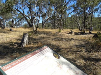
Warby Ranges Ryans Lookout JCD picture

Warby Ranges Ryans Lookout JCD picture

After travelling from Wangaratta to Beechworth I then checked the map and travelled about 14 kilometres out to the Warby-Ovens National Park. The location I chose was Ryan’s Lookout. I was on the air on 40 metres at 0601 and my first contact was with VK3SOG, Fred; then followed VK5EE/p QRP, Tom in Calectasia Conservation Park, in the South East of South Australia not far from Mount Gambier. As the band was very busy with established nets and lots of SOTA and Park activities by QRP portable stations it was not possible to find a clear frequency. So I became a portable chaser and used that wonderful facility available to us as amateurs: frequency agility! With five changes of frequency between 7080 and 7110 I had the following contacts: VK3MRG/p, QRP, Marshall on VK3 VE 007; VK5PAS, Paul; VK5GRW/p, Greg at Mount Buller (not in the Park sadly); VK5FMID, Brian; VK3AMB, Bernard; VK5FTRL, Tom; and those peripatetic folk, VK3YSP and VK3FOWL, Joe and Julie at Gunbower National Park; VK3HRA, Allen on VK3 VE  007; VK5TKK, Tim at Mount Gambier; VK3ANL, Nick and finally, VK3HCF, Col at Penola Conservation Park. Thanks to all those amateurs who gave me a call today, especially those 15 who helped make my visit to Warby-Ovens National Park so enjoyable.