Errinundra National Park, 26th April 2014, VKFF158

The Welcome sign for Errinundra NP

The Welcome sign for Errinundra NP

Fourteen contacts from Errinundra National Park was a good indication that this park was on the wanted list for a number of amateurs. I was on the air at 02:55 and my last contact was at 04:04. Getting to Errinundra was a long drive and I wanted to get out of the park and arrive at our accommodation before darkness. The Park was badly damaged in the recent fires and I was doubtful I would find a reasonable activation spot.

Fire damage at Errinundra NP JCD photo

Fire damage at Errinundra NP JCD photo

Eventually we came to a sign indicating a walk through old growth forest. It was a small circular car park with some picnic spots. For most of the time we were the only people present. My first contact was with VK3MTB, Tim; VK3ZPF, Peter; VK3ANL, Nick at the Alpine National Park; VK3HRA, Allen; VK3FQSO, Amanda; VK3PF/P3, Peter who needed this Park to complete 45 as a chaser; VK5HCF, Col; VK3UH, Ken;  VK5HCF, Col; VK5AV, Tim; VK2HRX, Compton on VK2 CT 003; VK2UH, Andrew; VK3MRH, Ron and finally, VK1RAN, Rob in Canberra.

Old Growth Forest Walk

Old Growth Forest Walk

Lind National Park, 25th April 2014, VKFF-287

I activated Lind National Park early in the morning of the 26th April 2014 (UTC 25th April). I was able to catch up with my South Australian mates on 7.073 at 22:40. I exchanged signal reports with VK5ADL, David; VK5TW, Trevor; VK5ZK, Gary; VK5KGP, Graham, VK5TH/P5, Trevor (I gave Trevor 5 and 8 and he gave me 2 and 1: I reckon he should trade in his radio!) and finally, VK5ZTJ/P5, who was camping on the Yorke Peninsula. The worst report I received was 4 and 5 and my best was 5 and 9 (except from VK5TH/P5).

I then checked 7.100 and had the following contacts: VK3FQSO, Amanda; VK3HRA, Allen; VK2NNN, Darren; VK2CCJ, Cliff with a magnetic loop: his signal was 5 and 9 and he gave me 5 and 8); VK5AV, Tim; VK2LAX, Rod; VK5HOS, Owen; VK1DI, Ian; VK2KP, Ken, VK5ICP, Col and VK5ZPF, Peter, making 17 contacts.

Lind National Park, one of Victoria’s oldest is small, a mere 1,370 hectares.  The Parks Victoria brochure suggests this park has no facilities for visitors and the recommended way of seeing the park is to drive around the perimeter: Princes Highway – Combienbar Road and then Euchre Valley Scenic Drive. Unfortunately the Euchre Valley Scenic Drive is closed due to the failure of two bridges in the February 2014 fires.  However, great views of the dense rainforest can be seen on the left hand side of the Princes Highway driving towards Cann River,  but there are no places to stop on the Highway and it is very busy. I activated from a spot on the Combienbar Road almost as far as the turn at Club Terrace. There was a small clearing on the edge of the Park. It was not entirely satisfactory because there were logging trucks on the road. A line drawing of the park can be found in the Parks Victoria brochure available for download.

Alfred National Park, 25th April 2014, VKFF-618

Like Lind National Park there are no facilities for visitors at Alfred National Park. Parks Victoria suggest that glimpses may be gained of the park as you travel along the Princes Highway. The Department warns that there is no-where to stop and the highway is busy. We found that the road narrows every so slightly through this area as it travels through a cutting. Parks Victoria indicated that the Park has very high conservation value for both flora and fauna.  The line drawing map in the parks brochure for Croajingolong National Park shows both Lind and Alfred National Parks. If you check the map you will see that the West Wingan Road which we took to gain access to Croajingolong National Park passes by Alfred National Park and we found a great access spot at the southern corner of the Park. I was amazed at the dense nature of the temperate rain forest. You would need to take a compass and or GPS to venture more than a few metres into the Park.

Thanks to the ten amateurs who gave me a call at Alfred National Park, therefore ensuring a successful VKFF activation. My first contact was at 06:52 with VK3EK/P3, Robbie on SOTA summit VK3 VK 144;  VK3MRG/P3, Marshall at VK3 VN 030; VK5NIG/P5, Nigel in Wingfield Conservation Park; VK3FKSA, Banaar; VK2NNN, Darren; AX5PAS, Paul; VK2MCB, Philip; VK3FQSO, Amanda; VK3AMB, Bernard and finally, VK7HKN, Kevin near Launceston.

Alfred National Park

Alfred National Park

Croajingolong National Park, 25th April 2014, VKFF119

Croajingolong National Park covers a vast area from Sydenham Inlet to the New South Wales border. We visited the Park on Anzac Day and then we activated Alfred National Park. We had earlier in the day visited Coopracambra National Park on our way to Victoria from Narooma in New South Wales. We travelled the Monaro Highway to Cann River. It was a three park day! And very challenging. We chose to gain access to Croajingolong National Park via the West Wingam Road and soon after passing the park entrance we took the Meuller Track and set up on the edge of the track hoping no one would decide to visit!

Croajingolong NP, Meuller Track to 'shack'

Croajingolong NP, Meuller Track to ‘shack’

On our way along the West Wingam Road we were confronted by a person with a Stop Sign (or Lolly Pop). In conversation with this person it had transpired that the v-double log truck had lost its load on a wet and slippery corner. While the logs were not huge nor were they matches! I wouldn’t like to be on the receiving end of the load coming loose. We were able to continue on our way after a few minutes delay. The driver later told me that was why he was working on Anzac Day. The picture shows the log truck on our return from the Croajingolong activation parked near the corner of Alfred National Park. I was impressed with the driver. When he saw our 4 x 4 parked near the Alfred National Park corner he stopped his vehicle and came over to see all was right with us. He had earlier parked the log truck for departure on the 26th April.

The log-truck with the load on board

The log-truck with the load on board

Another view of the log-truck

Another view of the log-truck

As the Victorians will tell you these East Gippsland Parks are a long way from Melbourne and are not activated very often. In South Australia on 40 metres conditions are often poor and it is very difficult to copy QRP stations even from my home station where I experience very few problems with noise.  I am hoping some Victorians will feel inspired to travel to East Gippsland and activate these magnificent parks. I need them all as a chaser!

I began my efforts at 02:16 with a contact with VK3YY/P3, Glenn in VK3 VG 003, Mount Toorongo. What a great way to start the activation! Then followed VK3MTB, Tim; then VK3JNI, Philip at The Lakes National Park, VK3RAN, operator Luke; VK3PF/P3, Peter at VK3 VE 056; VK2IB/P3, Bernard at the same location as Peter; VK3FQSO, Amanda; VK3ZPF, Peter; VK2CCJ, Cliff; VK3ZPF, Peter; VK3BHR, Phil; VK3JD, John at Port Melbourne; AX2UH, Andrew at Yass; VK3MRG/P3, Marshall on VK3 VN 017; AX5PAS, Paul; AX2UH, Andrew; VK3FB/P, Len; VK3TKK, Peter; VK3HRA, Allen; VK3ANL, Nick on VK3 VE 019 and Mount Buffalo National Park, VK3MRO, Tibor; VK2LAX, Rod and, finally, AX2CL/P2, Raffy on Bear Island.  I was very pleased to achieve 23 contacts well and truly activating the park for the VKFF award.

Coopracambra National Park, 25th April 2014, VKFF-113

Today we returned to Victoria from Narooma in NSW. We took the Pacific Highway and not too far out of Bega turned right onto the Snowy Mountains Highway before turning South on the Monaro Highway and crossing into Victoria with the Park on the left hand side of the road. Not too far into Victoria we saw a sign giving access into the Park and indicating Beehive Falls about two kilometres further on. I found a good spot complete with picnic tables and no other homo sapiens. VK3PF, Peter, who has activated the Park twice recommended this spot. We had it to ourselves.

I set up and 23 contacts later packed up. I was really pleased with the activation. I used a new to me, but pre-loved Yaesu 897D, running about ten watts. I purchased this radio from a deceased estate in Sydney after seeing an advertisement in Amateur Radio Magazine for December/January. My son collected it about three weeks ago and this was the first time I had a chance to put it on the air. It will be used in the longer term at slightly higher power, say 30 to 40 watts, to give me a better chance of working DX from parks and giving chasers a better chance of hearing me from remote locations. I need to investigate a battery capable of supplying a higher current draw for a longer period if time, but still remaining ‘portable’. I will study the blogs of other amateurs to see what they use when using their FT897Ds on higher power in the field.

Beehive Falls turn-off at Coopracambra National Park

Beehive Falls turn-off at Coopracambra National Park

Here are my contacts: beginning at 02:16, VK3YY/P3, Glenn on VK3 VT 026; VK3MTB, Tim; VK3JNI/P, Tim at the Lakes National Park; VK3RAN, Tony; VK3PF/P3, Peter on VK3 VE 056; VK2IB/P3, Bernard also on VK3 VE 056; VK3FQSO, Amanda; VK3ZPF, Peter; VK2CCJ, Cliff; VK3ZPF, Peter; VK3BHR, Phil; VK3JD, John; AX2UH, Andrew; VK3MRG/P3, Marshall on VK3 VN 017; VK5PAS, Paul; AX2UH, Andrew; VK3FB/P3, Len; VK3TKK, Peter; VK3HRA, Allan; VK3ANL/P3, Nick on VK3 VE 039, The Hump, at Mount Buffalo National Park; VK3MRO, Tibor; VK2LAX, Rod and at 03:10, AX2CL/P2, operator Raffy at Club Station on Bear Island.

Eurobodalla National Park, 22nd April 2014, VKFF – 0164

I had a great time at Eurobodalla National Park just seven kilometres south of Narooma. I drove down a well-maintained track towards an inlet and while I was setting up a Sea Eagle flew circuits above me – I would like to think she/he was checking me out!  I was on the air at 00:56 and after checking the frequency called on 7.095 and was answered by VK2AFA/P2, Sam, on VK2/ CT – 002; then VK6MB/P2, Mike, as I have never heard him before barely a hop-step and jump away; VK5LY, Larry; VK5PAS, Paul; VK3PI, Mark; VK3UBY, Col; VK2LAX, Rod; VK2FW/P2, Ray; VK2CCJ, Cliff; VK3XL/P3, Mike, on SOTA summit VK3/ VC – 007 Mt Macedon; VK1MBE/P1, Andrew on VK1/ AC – 040 Mt Ainslee; VK1RX/P2, Al on VK2/ ST – 015; VK3AFW, Ron and VK3PF/3, Peter at 02:14 on VK3 /VG – 003. Fourteen contacts, some for a few minutes, has enabled me to qualify my first VK2 National Park for the VKFF award.

A view of Narooma near board-walk

A view of Narooma from board-walk

At Eurobodalla NP JCD photo

At Eurobodalla NP JCD photo

Eurobodalla National Park, of 3,069 hectares, on the far South Coast of New South Wales, has beaches, wetlands, spotted gum forests and a great home for water birds. It also contains significant Aboriginal and European cultural sites. While we have visited a number of National Parks in New South Wales this was the first time I really paid attention to the spotted gum.  These are magnificent trees.  I checked the NSW Government web pages for Parks and it indicates that there are close to 900 Parks and Reserves in that State. What a challenge for a Park activator!

Burrowa-Pine Mountain National Park, 19th April 2014, VKff-069

We accessed the Burrowa-Pine Mountain National Park by a road less travelled. Taking the first left-hand turn from the Murray Valley Highway onto Jeffcott-Jewells Road we made our way to the Park boundary and then followed the Black Mountain Track just past the Bush Rat Track and just short of the Ross Lookout. The track is a comfortable two wheel drive track and I selected a point where I could easily turn our 4 x 4.

I used my tripod and nine metre squid pole and home-made linked dipole. I was hoping for a successful activation and my hopes were not dashed.

I began my day by calling VK2TWR/P2, Rod at 03:56, on SOTA summit VK2 SM 072 and then up five, VK3PF/P3, Peter on VK3 VE 072; VK2MT, Rob, on VK2 CT 001; VK3MTB, Tim; VK1MA, Matt; VK3VTH/P2, Tony in Ben Boyd National Park, VKFF026; VK3AMB, Bernard; VK3UBY, Colin; VK3XD, John; VK5PAS, Paul; VK2IB/P3, Bernard on SOTA summit, VK3 VE 082; VK3FIAN, Ian; VK3AFW, Ron; VK3ETC, Ethan; VK5KC, David; VK5CZ/M5, Ian; VK5FMID, Brian; VK2FLEX, Tim; VK3MNZ, Don; VK3XL, Mike; VK2IAX/P2, Richard; VK5LY, Larry; VK5NIG/P5, QRP, Nigel; VK2TWR/P2, Rod on VK2 SM 065; VK5GY/P5, Gordon at Bullock Hill CP and VK2IB/P3, at 05:43, Bernard on VK3 VE 061, making 26 contacts in all.

The Burrowa-Pine National Park was accessed fairly easily from the Murray Valley Highway, which traverses magnificent sub-alpine scenery. We were travelling from Shepparton to Corryong and the Park is just out of Corryong. We purchased our lunch in Wodonga and stopped to lunch at the Historic Trestle Bridge. I could not resist the temptation to take a photo of this trestle bridge on the Cudgewa Line. The line was closed on the 22nd January 1995. I have travelled to Cudgewa on a steam-hauled special train many years ago and it was an interesting experience to walk some of the road bed and experience the grades. The rail track bed is now called the High Country Rail Trail and we noticed many people using it: riding bikes, walking and walking dogs.

Historic trestle bridge on Cudgewa line

Historic trestle bridge on Cudgewa line

Another view of trestle bridge

.

Gunbower National Park, 18th April 2014

Gunbower National Park

Gunbower National Park

We approached this park from Cohuna. We called at the Information Centre to obtain a map of the park. We were also told that there had been about 60 millimetres of rain and that the track had been damaged. We found the track generally dry but soft on the shoulders with large patches of water remaining (see photo below).  We eventually came to a point where the track became a bog. We chose not to try and get through. After crossing the bridge at Gunbower Creek we followed the main road for just a few kilometres before taking the Nursery Track into the Park, then through the Gunbower State Forrest before emerging into the Park again near the Murray River. Nursery track is not clearly marked and we went just beyond the turnoff before noticing our error. The 4 x 4 just in front of us also made the same navigational error and on our way out of the Park we saw another car do the same thing. The Park sign is just too far off the road.

I chose spot away from campers on a ‘lawn’. The grass was green and the track dry. After setting up the squid pole on a stump and the linked dipole antenna in place I thought I would use the Ten Tec Argonaut V1. After checking 7.100 a few times I called CQ at 01:17 and was answered by VK3SRB/M2, Steve, near Parkes. Signals were good and after a short contact I worked VK5AR/M5, Allan; VK5FO/P5, Bob; VK5ZAR/P5, Arno in Clinton Conservation Park; VK5FMID, Brian; VK5PAS, Paul; VK5LY, Larry; VK5NJ, John; VK3AFW, Ron; VK3MQ, Rob; VK5MBD, Bill; VK3FQSO, Amanda, giving her a new Park; VK3BHR, Phil; VK3HRA, Allen; VK3UCD, David; VK2AWJ, John; VK3VZZ, Charlie; VK3AMB, Bernard; VK5NJ, John for a second time; VK2UH, Andrew; VK1MA, Matt; VK3TB,  and at 02:17 VK3GRW, Greg.  Twenty-three contacts in an hour I thought was great fun. Generally the band was quiet: there appeared to be few other signals on 40m, so thanks to all those who took time out to give me a call.

Easter campers among the trees

Easter campers among the trees

Nursery Track Gunbower National Park

Nursery Track Gunbower National Park

Hattah-Kulkyne National Park, 17th April 2014, VKFF – 231

Hattah-Kulkyne National Park: old pump-house

Hattah-Kulkyne National Park: old pump-house

I activated the Hattah-Kulkyne National Park on the 17th April, en route to Narooma in New South Wales, via Ouyen, Shepparton and Corryong. The Park is large: about 50,000 hectares. We took the Hattah Nature Drive which begins at the Lake Hattah Visitor Centre and stopped at the old pump-house which has been restored by volunteers. It provided a great spot for my activation. I used the low-level fence around the car-park to support my squid pole.

The following contacts were made beginning at 06:20 UTC, VK3AMB, Bernard; VK5FAKV, Shawn; VK3FI, Noel; VK5LY, Larry; VK5KGP, Graham; VK5WK, Graham; VK5FEKH, Errol and VK4GJP, Geoff at 06:58. Eight contacts in 40 minutes and then the band went dead! However, there were plenty of nets in action although these don’t work well with QRP stations and I resisted the temptation to join various queues. Well it is a successful activation as far as the Keith Roget Memorial National Parks Award is concerned, but I needed another two contacts to creep over the line and count for the VKFF.

First year anniversary SANPCPA, 5th & 6th April 2014, Scott Creek Conservation Park

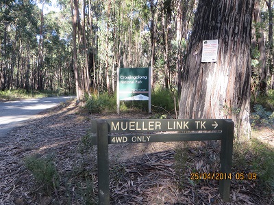
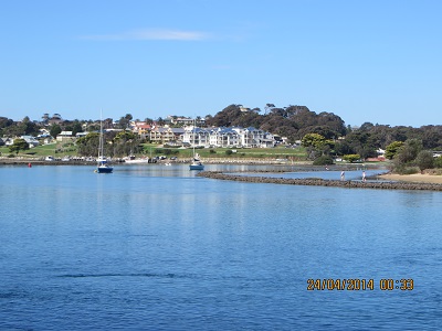
The 4th, 5th and 6th of April were set aside to celebrate the first anniversary of the SANPCPA award. It was a week end of exceptional activity especially on the 40 metre band. There were lots of activators, including some for the first time, and many chasers. My first contact was with VK5PAS/P5, Paul, who activated the Cox Scrub Conservation Park. I worked Paul from home. My last contact, from my home station, was on Sunday afternoon at 05:21 with VK5ARG/P5 (Amateur Radio Experimenters Group Inc.) Andrew at Belair National Park, 59 contacts later. These contacts included a number of new parks for me.

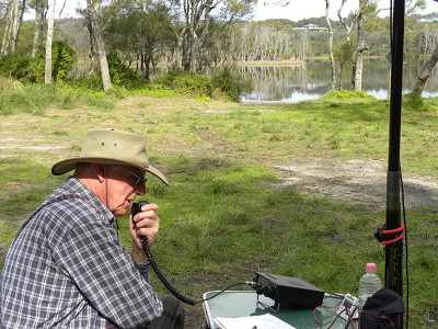
On Sunday morning local time, UTC 22:48 5th April 2014, I went back to Scott Creek Conservation Park, which I last activated on the 19th May 2013. I returned to Gate 8 on Mount Bold Road (See map on Friends of Scott Creek web page – link below). My equipment this time was a home made linked dipole for 20 and 40 metres and the Ten Tec Argonaut V1 (model 539).  Power was drawn from a 8.4 amp hour LIfePO4 battery, which was more than adequate for this activation. About one hundred metres inside the park there is a plateau which makes a fine activation spot. I enjoyed 52 contacts, including a number of new Parks and also with VK3PF/P3, Peter, on VK3 VC 001, Mount Matlock.

Here are my contacts: VK5NQP/P5, David at Cromer CP; VK5KET/P5, Andrew at Telford Scrub CP; VK5KC, David; VK5WG, Nev; VK3FQSO, Amanda; VK5GJ, Greg; VK5FMID, Brian; VK5LY/P5, Larry at Lowan CP; VK5PAS/P5, at Deep Creek CP; VK5AV, Tim; VK2AWJ, John; VK5IS, Ian; VK3AMB, Bernard; VK3UBY, Col; VK3CAT, Tony; VK3VIN, Ian; VK4FR/P5, Chris; VK5JP, Peter; VK5KRF/P5, Peter at Winninowie CP; VK5KGP, Graham; VK5KLV/P5, Winninowie CP; VK5DT, Darren;  and VK5FTRG/P5, Tom at Furner CP.  Then after UTC rollover, VK3VTH/P5, Tony at Carpenters Rocks CP; VK5FTRG/P5, Tom at Furner CP; VK5PAS/P5, Paul at Deep Creek CP; VK5ARG/P5, Andy at Horsenell Gully CP; VK5KLV/P5, Les at Winninowie CP; VK3CAT, Tony; VK5VCO/P5. Paul at Clinton CP; VK5KX/P5, Peter; VK5AV, Tom; VK5DJ, John; VK5LY/P5, Larry at Ridley CP; VK5TRM, Rob; VK2UH, Andy; VK5FMID, Brian; VK5NRG, Roy; VK5KET/P5, Andrew at Nene Valley CP; VK5LY/p5, Larry at Ridley CP; VK5NQP/P5, David at Charleston CP; VK5MJP, Patrick; VK5NE, Paul; VK5ZGY/P5, Greg at Naracoorte Caves NP; VK5ZAR/P5, Arno at Black Hill CP; VK3LY/M3, Bill at Yannack; VK3PF/P3, Peter at VK3 VC001, Mt Matlock; VK5MR/P5 Andrew at Tandappa CP; VK5HCF/P5, Col at Hacks Lagoon CP; VK5FTRG/P5, Tom at Reedy Creek CP; VK5PAS/P5, Paul at Eric Bonython CP and VK5STU/P5, Stu at Port Gawler CP.

Thanks to all those amateurs who gave me a call. It is greatly appreciated and I didn’t think Scott Creek Conservation Park would be so popular as the park has been activated three times: twice by me and once by VK5PAS, Paul.

Scott Creek History

Scott Creek History

Marie Steiner’s excellent book, published in 2000,  contains a wealth of research about the various sections of land which were incorporated into  Scott Creek Conservation Park, gazetted in 1985. ‘The Land Acquisition Act, passed in 1969′ (Steiner, 2000, p. 7), provided the basis for the State Government to pursue the long-term water needs of the community by purchasing the private land in the area now included in the Park. Not all of the land was in private hands but clearly the majority. Steiner’s (2000) book traces the challenges and hardships of trying to make a living on rocky, steep and, in places, infertile land.

The land was acquired to extend the catchment for the Mount Bold Reservoir, including the size of the dam. The plan was later modified because of unstable geological features which could lead to failure of a larger water holding.

The Crooked Chimney, Scott Creek CP

The Twisted Chimney, Scott Creek CP

The Twisted Chimney, for example, was on a holding of 17 and a quarter acres, Section 1190.  Steiner (2000, p. 53) sketches the history of the occupation of this section and others.  Such a long history, of 150 years of human occupation and endeavour, is reflected in the challenges of living in the area and the gaps in knowledge. She asks how could such a large parcel of land with this history, come to be created a conservation park (Steiner, 2000, p. 55)? Her answer is that ‘Scott Creek Conservation Park contains some of the most diverse and interesting areas of indigenous vegetation left within the Mount Lofty Ranges’ and that much of it ‘survived the impact of settlement’.

Remains of a tractor

Remains of a tractor

The picture shows the remains of a tractor, ‘discovered’ following a spraying of blackberries by the Friends of Scott Creek Conservation Park. http://www.users.on.net/~dld/Friends%20of%20scott%20creek/Website/

SA Water land (left) and Scott Creek CP (right)

SA Water land (left) and Scott Creek CP (right)

This picture shows the two fire breaks, one each side of the fence, separating the Park from SA Water land.